Showing posts with label Richmond. Show all posts

Sunday, April 25, 2021

Wellington Street Part 6: Postwar traffic on Wellington

Part 6: Postwar traffic on Wellington

   [Show/Hide Contents]

Back in January 2020, we left off with Part 5, in which we watched traffic get heavier on Wellington Street from the 1910s to the 1940s. After a hiatus to do more research and life getting in the way, we're now back to look at government interventions in and around Wellington Street in the ten years following the end of World War II.

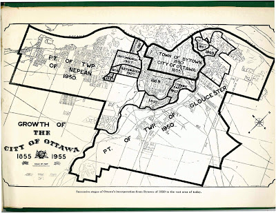
The biggest change for the City of Ottawa was on January 1, 1950,1 when Ottawa annexed nearly all nearby developed area, including Westboro, Ottawa West, Hampton Park, Highland Park, Woodroffe, Laurentian View, McKellar, Britannia, etc. Thich comprised 7,420 acres (3,000 hectares or 30 square kilometres) of Nepean and Gloucester Townships,2 as seen in the two large sections on the map below.3 Much of this was burgeoning suburban development which fed a daily stream of workers into downtown Ottawa.

Map of City of Ottawa from 1955 showing annexations/expansions up to that point, starting with Town of Bytown 1850 City of Ottawa 1855 in the middle and the largest expansions reading Pt of Twp of Nepean 1950 and Pt of Twp of Gloucester 1950.

Although Richmond Road was thus brought into the City limits, it retained its name west of Western Avenue, where Wellington ends.4 Since there were no major physical changes to Wellington Street specifically in this period, today's post will look at traffic in general on Ottawa's Wellington Street.
Monday, January 13, 2020

Wellington Street Part 4: As the City grows, so does Wellington (1880-1912)

   [Show/Hide Contents]


Before our foray into the east end of Wellington Street in the previous post, we were talking in Part 2 about the first roads in Ottawa and how the fledgling town's road network began to develop in the new neighbourhood that would one day be called LeBreton Flats.

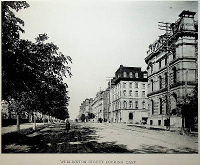
In this post we'll look at the period from about 1880 to 1912, during which time rail lines cross over Wellington at grade, fires ravage the western part of the street, Ottawa absorbs various suburbs, and an excessive number of bylaws authorize the renaming, widening, and paving of Wellington Street. To set the scene, here's what it looked like to walk in the middle of Wellington Street in 1898:1

Photo taken from Wellington Street, looking east, at around O'Connor Street, with the street extending into the horizon. From left to right: The stone and wrought iron fence at the perimeter of Parliament Hill, the north sidewalk (material unclear), a boulevard planted with a continuous row of trees, the roadway which is dirt and rutted, a bicyclist in the road heading straight toward the camera, a horse drawn carriage further away on the opposite side of the street, telephone poles each with nine rows of eight insulators, the south sidewalk (concrete?) with some trees, buildings on the south side of Wellington Street, all around 4 storeys tall. The photo has an all-caps caption at the bottom (from the book from which it was scanned), Wellington Street Looking East

Thursday, January 2, 2020

Wellington Street Part 1: Ottawa's earliest roads and their namesakes (1800-1826)

   [Show/Hide Contents]

To go beyond a simplified summary and conduct a thorough review of the history of changes to all the roads in Ottawa called "Wellington Street", we need to go back to Ottawa's earliest days as a settlement and where that all came from.

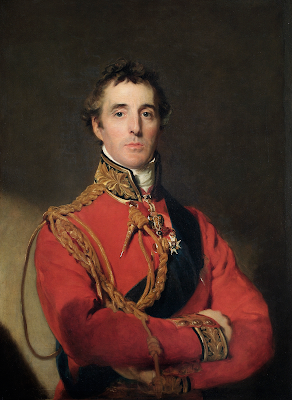
It's easy enough to say "Richmond Road was named after the Duke of Richmond and Wellington Street was named after the Duke of Wellington", but that doesn't answer the questions of who those people are and what relation they bore to Ottawa and to the people who built its first roads. So let's get into that.