Ever hear someone talk about a pole in the middle of a sidewalk or path but you suspect they're exaggerating the degree to which it's blocking pedestrians? Well I've got one for you, with a photo to prove it!
I'll quickly run through how it got there (why it did remains unknown...). The fixture in question is on Albert Street, at the site of the Lorne building, which I've blogged about in posts with the label
90 Elgin.
Here's the back of the Lorne building in May 2011, and the Albert Street sidewalk, looking east toward Elgin, with a fire hydrant and street light more or less at the edge of the sidewalk at the left:
Similar angle in August, after exterior demolition started. A rendering of the new building is on a sign:
In late November 2011, the sidewalk was incised down its length about a foot and a half behind the curb line:
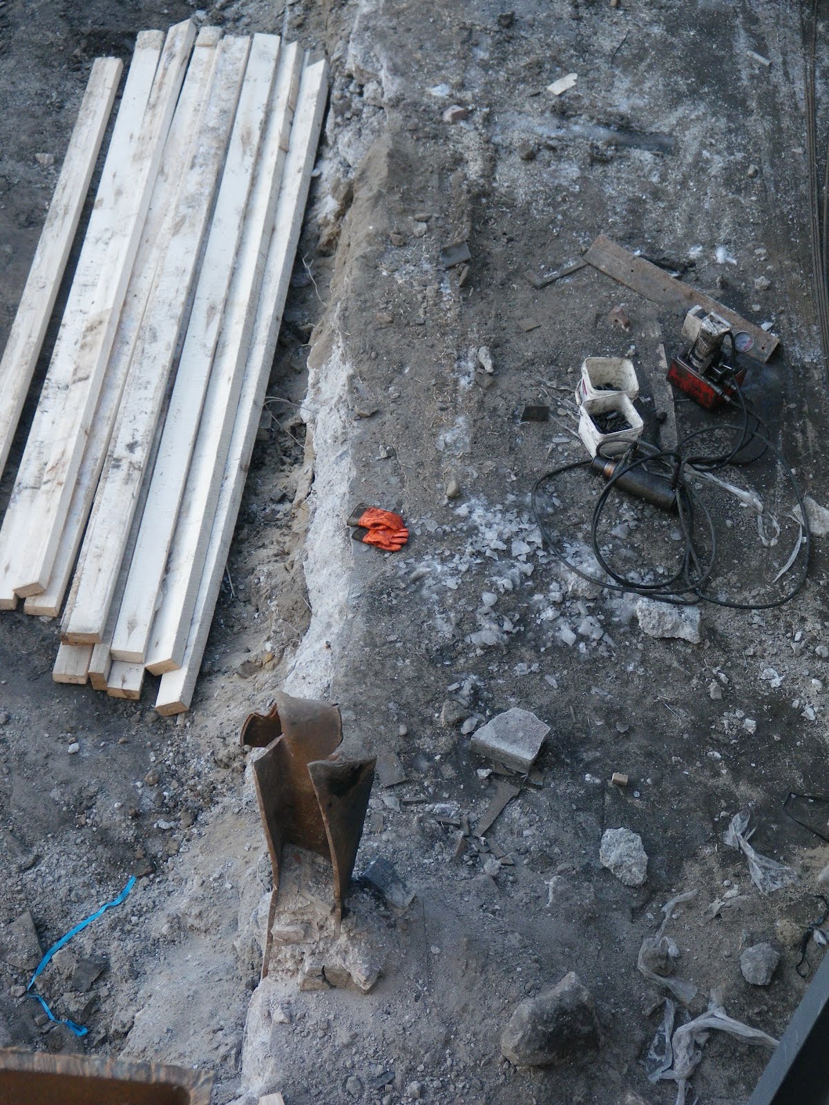
The back two thirds of the sidewalk were removed by the end of November. The fire hydrant from previous photos is just on the other side of the streetlight. Ever wonder what's under the concrete of a sidewalk? Well, here's a photo of it anyway:
Piles were driven right at the cut line and wooden 4x4 fenceposts were strapped to them. Early December 2011.
The same scene from the Slater Street side, looking across to Albert. The piles are interleaved with wooden boards to hold the street up, as I described in detail for the EDC building at 150 Slater in a
post in August 2009.
While the wasteland of the site is fun, here's a cropped closeup of the same shot. The hydrant is gone. I only noticed looking at these photos that the streetlight was actually strapped to an I-beam pile during this phase of construction. Weird, but I guess it works!
Since Elgin Street is along Confederation Boulevard, the slightly-less-ugly-than-normal NCC spec hoarding was attached to the fenceposts seen in the previous scene. Needless to say, the sidewalk was closed.
...Unless you work there. (Ever notice how big a tower crane's hook block actually is? If I were as far away from it was the tower crane's operator is, I'd be pretty spooked to have it so close to workers!)
The above shot was from June 2012, and it looked more or less the same as it did at the end of 2011.
By Mid-September, the wooden fencing was taken down and replaced with temporary modular metal fencing.
Cropping in again on the photo, the fire hydrant is still there, and, with the blue top indicating it's apparently still in service.
By the end of October, 2012, the streetlight was removed, and the hydrant is yellow. It's actually not the same hydrant as the one before, which suggests it might have been moved also.
In mid-November, they reinstated the sidewalk and put scaffolding over it since the towers were (and are) still under construction right next to it.
Only, uh...
I'm not sure why the hydrant is in the middle of the sidewalk (the one we've been following is in the distance; the one seen here is mid-block, closer to Metcalfe). Maybe the builder and the City couldn't agree on whether to put it at the front or back of sidewalk, so they split the difference.
For now, the scaffolding over it seems to be keeping the snow away. But when that's gone, I'm not sure how sidewalk plows are supposed to make their way along here.
Luckily, it's just a 'temporary' situation. In all likelihood, there will be a standpipe built into the wall of the building, and the sidewalk will be redone with the final, fancy landscaping.
[Tune in on Wednesdays at noon for a new pedestrian-themed blog post. View the Pedestrians label for previous Peds on Weds posts]