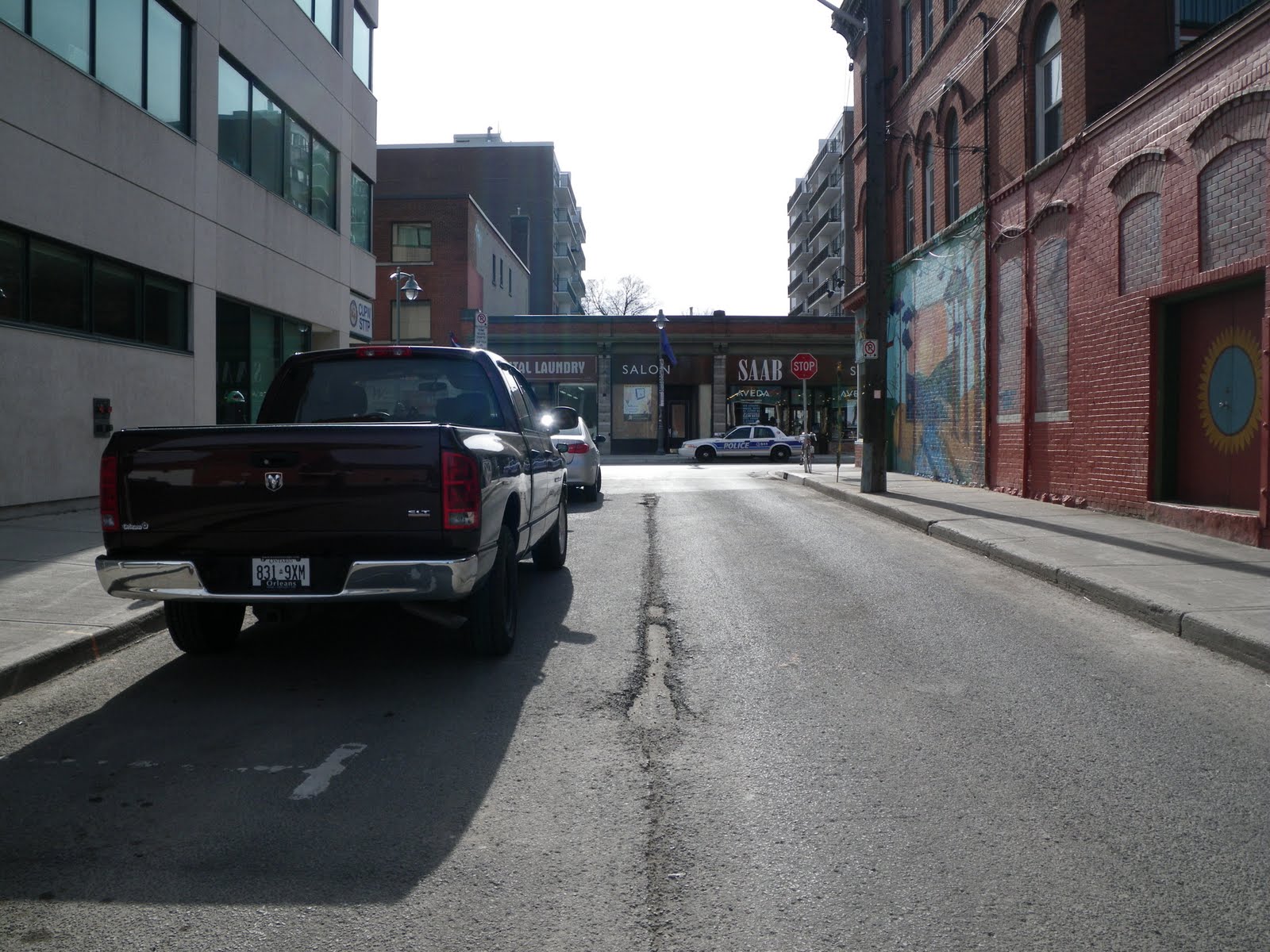
Spring is finally here, and with it the trees are blossoming. Across from Minto Park* on Lewis Street, this tree makes for quite the 3D experience:
Also within the Golden Triangle, a couple blocks east on Lewis, at MacDonald, is another blooming bush whose lotus-like flowers look like they're floating in the air when you look at them with 3D glasses on:
Let's hope the nice weather lasts!
*On the topic of Minto Park, the CCCA is hosting its annual BBQ, plant sale, and e-waste drop-off at the annual Minto Park Sale, on Saturday, June 14, 2014. These fundraisers will be important for the CCCA as we will need funds for expert assistance as we prepare for our OMB appeal of the Centretown Community Design Plan this fall. If you'd like to volunteer for the CCCA's Minto Park Sale activities or for the OMB appeal effort, please contact the CCCA (ccca@centretowncitizens.ca).
[Tune in on Thursdays at noon for a new 3D image. View the 3D label for other posts with 3D images. 3D FAQ]
Showing posts with label Lewis. Show all posts
Thursday, May 22, 2014
Friday, June 15, 2012
Minto Park Sale 2012
Tomorrow is the annual Minto Park Sale, organized by Councillor Diane Holmes (disclaimer: I work in her office). This sale provides a chance to have a yard sale table for those who live in buildings without a yard. And it takes place in historic Minto Park, on Elgin Street.
This year, there will be over 70 tables, plus other events. Funds raised by table rentals will go to Women's Initiatives for Safer Environments (WISE). In addition, there will be a raffle for many prizes of gift certificates along Elgin Street.
As mentioned by CCCA president Jordan Charbonneau in his May 2012 message to CCCA members, the association will be holding its fourth annual barbecue in Minto Park during the event, raising funds for the CCCA and WISE. I will be returning in my role as grillmaster to serve up hotdogs and veggie dogs for two dollars apiece.
As usual, the CCCA's hard-working Trees and Greenspace Committee will be hosting its annual plant sale during the event, the proceeds of which go to the CCCA Tree Fund, dedicated to improving greenspace in Centretown.
New for this year is another CCCA fundraiser, an e-waste drop off site. Drop off your used electronics at the dumpster provided on Lewis Street next to the park for free, and the CCCA will receive funds from Ontario Environmental Stewardship according to the total weight of electronics collected. So haul out that old TV or computer monitor and clear out your closet of that old VCR and discman! A full list of accepted items is on the this event page.
There are also a number of other events, including a street sale on Waverley, the Elgin Street Book Sale, and a strawberry social at Knox Church:
None of this could happen without the contribution of volunteers. The CCCA will be needing volunteers to help with the electronics drop-off site and the BBQ, and also to help people fill out membership forms to join the CCCA (at a bargain price of $5/year!). Contact ccca@centretowncitizens.ca, or just show up.
Minto Park (named after the Governor General), is a great little heritage park with a fascinating history:
So come celebrate the park, the neighbourhood, and the many activities and causes that make up this growing annual event.
See you on Saturday!
There are also a number of other events, including a street sale on Waverley, the Elgin Street Book Sale, and a strawberry social at Knox Church:
None of this could happen without the contribution of volunteers. The CCCA will be needing volunteers to help with the electronics drop-off site and the BBQ, and also to help people fill out membership forms to join the CCCA (at a bargain price of $5/year!). Contact ccca@centretowncitizens.ca, or just show up.“Minto Park was created following a petition from residents of Lewis and Gilmour Street to
the City of Ottawa Board of Park Management. The City purchased the vacant land in 1898
from J.R. Booth and created Minto Square named after the newly arrived Governor General
Lord Minto. Minto Square was designed as an ornamental park with interlacing half circles,
trees and planting beds, to be enjoyed for its visual appeal rather than for active recreation.
The buildings facing Minto Park, constructed between 1892 and 1906, comprise a coherent
streetscape representing the changing architectural styles and building craftsmanship
popular in Ottawa at the turn of the century. Alexander Garvock, a builder, was one of the
first residents of Minto Park. He built two of the houses facing the park. The Church of Our
Father, now Eglise Unie St-Marc, at the southwest corner of the park, was designed in 1900
for the Unitarian church by the architectural firm of Arnoldi and Ewart. Minto Park’s
significant grouping of low scale residential buildings, exhibiting compatible stylistic
attributes and surrounding a planned square, form a special place in the historic
development of Ottawa” (from the City of Ottawa, quoted in this PDF)
So come celebrate the park, the neighbourhood, and the many activities and causes that make up this growing annual event.See you on Saturday!
Wednesday, October 5, 2011
O'Connor and Kent: Cross with care
It feels like I took this photo just a few weeks ago, but it was actually June 2010. The street we're looking down is Lewis (my favourite stretch along my now-famous shortcut), and the cross street is O'Connor.
Like Kent Street, the one-way traffic on O'Connor travels pretty darn fast when it gets the green light. Both O'Connor and Kent were widened decades ago to be very close to the buildings, leaving little room to see around the corner when you're at the stop sign on the cross street.
I didn't see the collision, but I suspect this is what happened to the unfortunate driver of this sedan: he looked as far as he could up O'Connor for a gap in traffic to cross at Lewis, and was slammed by the SUV coming down O'Connor far enough away but going fast enough (not necessarily speeding) to not be visible from the side street.
This was a common occurrence on Lyon Street before the speed humps were installed on it. The traffic engineers were up in arms at the thought of speed humps on an arterial road, but so many cars had crashed into the house at the south-west corner of Lyon and MacLaren that the community had had enough and political will overruled the engineers. Now Lyon still carries lots of traffic, but that traffic is calm enough for a bike lane to run alongside.
The Centretown Community Design Plan suggests looking at converting Metcalfe and O'Connor back to two-way traffic. The plan's consultants have suggested this (as well as the rest of the transportation aspects of the CDP) be investigated as part of the Downtown Ottawa Mobility Overlay, a.k.a. Downtown Moves. Now that the DOMO and its terms of reference are out, we see that Centretown isn't part of the core study area. We'll see how many resources, if any, go toward looking at the one-way streets.
In the meantime, when you're crossing Kent and O'Connor on a side street, either on a bike or in a car, be careful!
[Look for more one-photo posts under the label Singles]
I didn't see the collision, but I suspect this is what happened to the unfortunate driver of this sedan: he looked as far as he could up O'Connor for a gap in traffic to cross at Lewis, and was slammed by the SUV coming down O'Connor far enough away but going fast enough (not necessarily speeding) to not be visible from the side street.
This was a common occurrence on Lyon Street before the speed humps were installed on it. The traffic engineers were up in arms at the thought of speed humps on an arterial road, but so many cars had crashed into the house at the south-west corner of Lyon and MacLaren that the community had had enough and political will overruled the engineers. Now Lyon still carries lots of traffic, but that traffic is calm enough for a bike lane to run alongside.
The Centretown Community Design Plan suggests looking at converting Metcalfe and O'Connor back to two-way traffic. The plan's consultants have suggested this (as well as the rest of the transportation aspects of the CDP) be investigated as part of the Downtown Ottawa Mobility Overlay, a.k.a. Downtown Moves. Now that the DOMO and its terms of reference are out, we see that Centretown isn't part of the core study area. We'll see how many resources, if any, go toward looking at the one-way streets.
In the meantime, when you're crossing Kent and O'Connor on a side street, either on a bike or in a car, be careful!
[Look for more one-photo posts under the label Singles]
Wednesday, August 31, 2011
Lewis Street potholes fixed after 18 months
View other posts on these topics:
Bank,
Cycling,
Lewis,
Needs Repair,
Roads
Do you remember back in March 2011 when I complained about the potholes on Lewis Street between O'Connor and Bank?
As a refresher, this is what the potholes looked like in March of the previous year after a cold patch was applied:
And this is what they looked like in March of 2011. The water had flushed the patches clean out of the holes, which were back and bigger than before.
Well, good news! I'd forwarded a link to that blog entry to some folks at City Hall, and though I didn't get any reply to those e-mails, we've finally gotten some results. As I had suggested, the City scraped off a chunk of asphalt and laid a good solid strip down where these potholes were.
This method worked at the Bank Street end of the block (as I had suggested they do when putting the final layer of asphalt on the Somerset to Arlington stretch of the Bank Street reconstruction in 2010), and has survived seamlessly through the winter since.
Now I don't have to worry so much when I lean my bike to turn onto Lewis from O'Connor! O'Connor-Lewis-Bank-James-Lyon is a very convenient bike route for going south-west through Centretown, because it has low traffic and few red lights.
As a refresher, this is what the potholes looked like in March of the previous year after a cold patch was applied:
Now I don't have to worry so much when I lean my bike to turn onto Lewis from O'Connor! O'Connor-Lewis-Bank-James-Lyon is a very convenient bike route for going south-west through Centretown, because it has low traffic and few red lights.
Friday, March 25, 2011
The right and wrong way to fix potholes on Lewis
Last February, I was pretty frustrated by the string of potholes that runs right down the middle of Lewis Street, between O'Connor and Bank Streets. They looked a lot like these ones, which are just before Bank (read some history of the businesses at that intersection in this post). This photo was taken almost exactly a year ago:
It's clear that the top layer of asphalt along Lewis had been paved one half of the street at a time, and because the roadway drains toward the centre line (or at least doesn't sufficiently drain away from it) water seeps into the seam. When the water freezes, it separates the top layer, creating the potholes.
Wednesday, February 9, 2011
C.C.B. Electric Works and Red Apron
This is C.C.B. Electric Works, at 564 Gladstone Avenue. As the sign says, it's been serving Centretown with electric motors and parts since 1907. The owners proudly display antique equipment in the middle section of their storefront, which used to be Nicastro's.
C.C.B. stands for Crowe, Costello and Black, and was previously at 378 Bank Street, across from Lewis Street. Here's a shot from 1979 supplied by Midcentury Modernist.
Friday, October 29, 2010
The old tree switcheroo on Metcalfe
View other posts on these topics:
CCCA,
Lewis,
Metcalfe,
Planning and Development,
Renovation,
Trees
For fans of the Urban Tree Conservation by-law, including those on the Centretown Citizens Community Association's Trees & Greenspace Committee, there has been a lot of activity lately on a couple blocks of Metcalfe around Gilmour, Lewis, and Waverley.
Back in October 2009, 296 Metcalfe (at Lewis, South-West corner) changed occupants from Bridgetech Systems to Dr. Patrick Murphy's hearing institute.
In the front lawn was a large tree in full fall colours:
In early November, the tree was removed. While the by-law requires a sign to be posted one week before and one week after the tree removal, this doesn't apply to diseased trees that are a safety hazard (a permit is still required, just no sign).
Unfortunately, this makes it impossible to distinguish between an illegal tree removal and the legal removal of a diseased tree, as explained by David E. Barkley, Manager of Forestry Services at the City of Ottawa, that month in response to my inquiry:
Finally, in October 2010, the City installed new trees on the boulevard.
Down the block and across the street, the Executive apartments at 305 Metcalfe had some landscaping work done in July 2009, removing some brush:
In this shot from mid-August, there's a fair size tree on the boulevard, maybe eight inches in diameter at chest height.
But by March 2010, that tree was removed--I'm not sure by whom--leaving just a stump. As you can see in the photo from in front of 296 Metcalfe above, it looks like there weren't any new trees planted in front of the Executive.
Then not too far away, the Chancery of the Nigerian High Commission has done some exterior renovations as well. At the end of March 2010, we can see three trees along Metcalfe, each three and a half storeys tall, plus shrubs along Lewis:
By late June, they had removed the trees and shrubs and were preparing to re-sod the lawn.
They took this opportunity to apply a marble finish to the bare concrete bed at the ground level. This was complicated by the fence right in front of that surface.
In mid-October, a second fence was added to the building's perimeter, and two small saplings were planted to replace the three large trees. Hopefully they will survive in that narrow grassy boulevard like the three old trees did on the lawn.
North of this stretch, Metcalfe has lots of trees that make it a pleasant street, despite being a rush-hour traffic artery.
While the loss of five mature trees is troublesome, in a couple of decades the five new trees planted will be big enough to help restore Metcalfe to its former glory, like Kent Street before it was widened, or Bronson Avenue after it is narrowed.
If they don't get cut down again.
[The series What I learned in Montréal resumes next week.]
Back in October 2009, 296 Metcalfe (at Lewis, South-West corner) changed occupants from Bridgetech Systems to Dr. Patrick Murphy's hearing institute.
The tree removed was a private tree, a permit was issued for the removal but due to the poor condition of the tree, it was deemed a safety hazard which means the posting of the permit was waived, the normal requirement for posting is 7 days prior and 7 days following the removal.A couple days after the machine's first bite off the tree, all that was left was a pile of mulch.
I have attached the web link to the report and by-law in case you would like to review the details
http://ottawa.ca/calendar/ottawa/citycouncil/occ/2009/06-24/pec/8-ACS2009-ICS-PGM-0094%20-Urban%20Tree%20Conservation.htm
www.ottawa.ca/urbantree
North of this stretch, Metcalfe has lots of trees that make it a pleasant street, despite being a rush-hour traffic artery.
If they don't get cut down again.
[The series What I learned in Montréal resumes next week.]
Monday, November 16, 2009
Bank Street Phase III, Part 5: Surfaces
[This post is part of a series on Bank Street's new look. See the introduction and part I here.]
Last time, I shared some photos of the benches on Bank Street. Incidentally, they've removed the new benches South of Somerset, too. I think they were just doing a dry fit before removing them for the Winter.
Today it's surfaces. Lots of the more interesting aspects of the Bank Street redesign is the new, broader sidewalks and the various pieces of street furniture on them, but the surfaces that stretch between the sidewalks--i.e. the roads and crosswalks--have enough going on to merit their own post.
Here's a photo looking South down Bank at Lisgar from July 2007 on the Phase II portion of Bank Street, from Laurier to Somerset, in case you've forgotten how lumpy and bumpy Bank Street used to be. I believe they were drilling some core samples to get an idea of exactly what's underneath Bank Street in preparation for the following year's digging up of the century-old infrastructure. At the right is a newspaper box for Transcontinental Media's short-lived downtown weekly paper, the Ottawa City Journal:
After the underground work was complete, they paved a layer of asphalt in July to contain things. Here are some of the paving machines at Gilmour in front of the Rogers Plus store, at the end of a block-long carpet of asphalt. It doesn't go all the way to the curbs, because there was still more finishing to do on them.
South of McLeod, partial access to Bank Street was maintained so that people could get into and out of the mid-block parking lots on Bank. In late June, this alley of asphalt was laid to give drivers something more reasonable to drive on. The paving workers were very precise, following the string guide line to the inch:
In the final preparations for opening of the block, a pair of layers of asphalt were laid, stretching from curb to curb. This was taken in Phase II (looking North at Cooper) on November 14, 2008, with two more weeks of preparations before the street reopened.
By contrast, the second layer of asphalt went on this year's segment at the end of September, as seen here looking North up Bank from Gladstone. They've refined their techniques and were able, and by November 14 this year, Bank Street was already back open!
It seems more often than not that they pave asphalt right on or before a rainy day. You can see the water beading up on the surface of the asphalt. These bags of calcium chloride flakes were stacked outside Herb & Spice at Bank and Lewis. When applied, it looks like someone dropped piles of styrofoam pellets over the dusty gravel, apparently to control dust.
Once the second layer of asphalt was paved, the street looked nearly ready to go. Since the streets were still closed to cars, they became a de facto pedestrian space. These folks animated the street with a street hockey game between Gilmour and MacLaren streets, using construction pylons as goalposts. Others used the closed (or open, depending on how you look at it) road to practise their skateboarding tricks.
Before the street could be re-opened, these asphalt berms had to be installed along the edges of the streets to smooth out the lip on the edge of the sidewalks. I'm not entirely sure what the lips are for, as they come and go. For example, across the street in this photo, in front of the Staples store at Bank and Waverley, you notice that the berm (and the lip it covers) stops at the lamppost, and the sidewalk continues with no lip. I suspect the lip is drainage-related. (Photo taken last week)
Next to come are the crosswalk markings. Guide lines were spray-painted on the crossing of Lewis so that the stop line and crosswalk lines could be drawn precisely.
The following day, the lines were painted. Because the closed roads prevent cars driving over them, these lines at MacLaren were still shiny when I photographed them on Thursday night:
Most of the above describes the work done on Phase III, the section under construction this year. Last year, the majority of this same work was on Phase II, between Laurier and Somerset. Finishing touches for Phase II were done this year, and similar finishing touches will be done on Phase III next year.
In this photo, taken in mid-August 2009, they've dug up one of the manhole covers at Bank and Somerset (the first photo in this post shows this being done at Bank and Cooper), and applied a temporary cold patch around it. The four holes, which were frightening to cycle over, allowed drainage and a leverage point to re-extract the manhole cover more easily. They'll need to raise it up with a spacer when they pave the final layer of asphalt. This also explains the height discrepency at the curb requiring the temporary berm--You can see the berm that was installed last year coming down off the lip at the edge of the curb.
About a week after they dug up the manholes, the final layer of asphalt had been laid (although the ones at the intersection of Bank and Somerset would remain for a number of weeks). Here's a shot looking South at Lisgar again--much nicer than in the photo above from two years ago! The crosswalks have been painted, and marks made for the yellow centre line to be painted.
On the cross-streets (in this case, Lisgar again), they needed to scrape off some of the old asphalt to give a straight cut for the asphalt to cover over smoothly. If you click the photo to zoom in, you can see the four holes around the manhole cover. The old crosswalk paint will simply be paved over.
The final asphalt makes for a smooth transition on the cross streets. In this case, Nepean Street.
In mid-September, these paint marks outlined the location of crosswalks. You'll note that they line up well with the border of the concrete sidewalk.
The lines guide a slice through the asphalt and crosswalk pavers are installed over a bed of sand:
The precast paver crosswalks help to define the crosswalk as a pedestrian zone and continuation of the sidewalk. Looks pretty good, if you ask me.
Tune in in a couple days for my Part 6: Bike Racks (my favourite).
Note also the upcoming CCCA meeting on Tuesday night, 7pm in the Honeywell Room at City Hall.
Last time, I shared some photos of the benches on Bank Street. Incidentally, they've removed the new benches South of Somerset, too. I think they were just doing a dry fit before removing them for the Winter.
Today it's surfaces. Lots of the more interesting aspects of the Bank Street redesign is the new, broader sidewalks and the various pieces of street furniture on them, but the surfaces that stretch between the sidewalks--i.e. the roads and crosswalks--have enough going on to merit their own post.
In this photo, taken in mid-August 2009, they've dug up one of the manhole covers at Bank and Somerset (the first photo in this post shows this being done at Bank and Cooper), and applied a temporary cold patch around it. The four holes, which were frightening to cycle over, allowed drainage and a leverage point to re-extract the manhole cover more easily. They'll need to raise it up with a spacer when they pave the final layer of asphalt. This also explains the height discrepency at the curb requiring the temporary berm--You can see the berm that was installed last year coming down off the lip at the edge of the curb.
Note also the upcoming CCCA meeting on Tuesday night, 7pm in the Honeywell Room at City Hall.
Tuesday, November 10, 2009
Bank Street Phase III, Part 2: Lights
View other posts on these topics:
Bank,
Construction,
Florence,
Frank,
Gladstone,
Gloucester,
Laurier,
Lewis,
Lisgar,
MacLaren,
McLeod,
Nighttime,
Pedestrians,
Sidewalks,
Somerset
[This post is part of a series on Bank Street's new look. See the introduction and part I here]
Last time, I talked about the new, wider sidewalks, and the installation process for those. This part I'll be talking about the new street lamps on Bank.
Phase I of the reconstruction project, from Wellington to Laurier, has these decorative lamps. They have a flat arm, from which is suspended a round lantern. I took this photo a month ago, after the Shopper's Drug Mart moved out of this building (it's now on the ground floor of the Mondrian). What I find remarkable about it is that the noon-hour pedestrian traffic actually resembles the types of busy pedestrian environments you see in architectural renderings:
But I'm focusing more on Phase II and Phase III of Bank Street, from Laurier to Somerset and Somerset to Arlington, respectively. They have a different style of lamp from the Northern section of Bank.
Here's what the street lamps looked like. They only decorative element were the retro Bank Street Promenade roundels. You'll note that the old posts were suspended on pyramidal bases. When the ground freezes and thaws, the sidewalks ride up and down the slanted surface, creating cracks when they settle back down.
The new streetlamp bases can be seen here lying just south of Somerset, awaiting installation. They are elliptical on the cross-section, but the sides are vertical. They have large bolts built in for attaching the street posts, and holes in the side connect to conduits coming through the middle for electrical connections. Some more concrete utility access ports are stacked behind them.
As mentioned in the previous post, Phase II of construction (Laurier to Somerset, mostly done in 2008) had separate installation for the pieces of sidewalk with and without lamppost bases. This allowed for views like this one, where we can see the connections under the sidewalk looking North from Lisgar. The photo was taken in late October 2008, when the Mondrian's podium was still under construction in the background.
South of Somerset, in Phase III, the sidewalks were constructed more continuously. In this shot (from the same day as the photos in front of Hartman's in the previous post), it's clear that the square of sidewalk with the lamppost is being installed at the same time as the other squares on the block.
As you can see above, they were pouring the sidewalk where the lamppost had already been installed on the West side of the street, in front of Hartman's. Across the street at the same time, they were installing the lamppost where the sidewalk had already been poured. This was at the end of this past August, as you can see by the nearly-completed Mondrian.
Here's a lamp in early September near Gilmour, shortly after installation. They had not yet been illuminated. There's something about the style of the lampposts that doesn't fit here, though. It's just too modern for the ornate buildings on this block.
Not that they're ugly. They make a decorative touch on the rest of Bank street, and the series of them creates a nice rhythm when you view them at the right angle. This shot is looking South along the East sidewalk from Gloucester.
Unfortunately, the hydro wires were only buried North of Gladstone, paid for by the Bank Street Business Improvement Association (BIA). South of Gladstone, there's no BIA to pay to bury the hydro wires, and the City didn't want to cover the cost, so wooden poles were kept for overhead hydro wires. As with on Preston Street, a variant of the street lamps were used to keep the rhythm of the lamps while using the wooden poles (having separate lampposts in addition to the hydro poles would have cluttered up the streetscape too much).
But the result is really really tacky. Here's one of them in front of the Metropolitan Bible Church building:
I was also surprised to see many of the old poles with the 50's Diner-style Bank Street Promenade roundels still up after much of the work was done. Particularly this one at Bank and Florence, where the sign was destroyed in the fire that consumed the building on the corner back in 2003. Surely they wouldn't leave that old frame up there?
There's another one here in front of Hackett Shoemakers at Frank Street. This view is from late April, before most of the work reached this part of Bank Street.
Not sure which one is Hackett? Maybe that's because its sign was obscured by this roundel, which is still there after the new lampposts were installed!
Now, a keen eye would note that the sidewalk squares with these old posts were not poured with concrete. That's because the posts were only kept long enough for the buried hydro wires to be installed and activated. When the posts and overhead wires were no longer needed, they were removed in late October/early November, greatly simplifying the streetscape (though one of those big ugly sign advertisement boxes was installed in front of the Watch Clinic). Note also that a Vietnamese place is opening up in the former Don Alfonso's restaurant. Vistek has also moved from this location, down to where the art supply store used to be at Argyle.
The new lamps create a great ambiance for Bank Street. I had to take a few versions of this photo to get the lighting right. But this photo (looking South from Gilmour) was taken at 9:30 pm and it's pretty dead--let's hope that when the street is re-opened Bank Street once again becomes a vibrant place to live, work, and shop all hours of the day.
Tune in in a couple days for Part III: Trees
Last time, I talked about the new, wider sidewalks, and the installation process for those. This part I'll be talking about the new street lamps on Bank.
Phase I of the reconstruction project, from Wellington to Laurier, has these decorative lamps. They have a flat arm, from which is suspended a round lantern. I took this photo a month ago, after the Shopper's Drug Mart moved out of this building (it's now on the ground floor of the Mondrian). What I find remarkable about it is that the noon-hour pedestrian traffic actually resembles the types of busy pedestrian environments you see in architectural renderings:
Here's what the street lamps looked like. They only decorative element were the retro Bank Street Promenade roundels. You'll note that the old posts were suspended on pyramidal bases. When the ground freezes and thaws, the sidewalks ride up and down the slanted surface, creating cracks when they settle back down.
But the result is really really tacky. Here's one of them in front of the Metropolitan Bible Church building:
Subscribe to:
Posts (Atom)