Showing posts with label Vehicles. Show all posts

Wednesday, April 23, 2014

Peds on Weds: Delivery door design

Is this delivery truck at the Delta Ottawa City Centre too big, or is the delivery entrance too small?


Either way, it results in the truck blocking the sidewalk completely, and even this short truck diverts pedestrians not just into the roadway, but into the travel lane, to get past. Not the only pedestrian issue at this '60s-built hotel and conference centre.

[Tune in on Wednesdays at noon for a new pedestrian-themed blog post. View the Pedestrians label for previous Peds on Weds posts]
[Look for more one-photo posts under the label Singles]

Monday, February 10, 2014

Snow removal on Bank Street (video)

On the left, the snow accumulation on Bank Street's west sidewalk from the previous snowfall. On the right, the mostly-bare road and sidewalk minutes after the City took the same snowbanks away from the east side of Bank Street last night:


I described the process in more detail in my 2012 post, "Snow removal on Kent." In summary, some very deft sidewalk plow operators push the snow from around various obstacles on the sidewalk into the road. Then graders like this one go by to arrange this snow into a straight row on the roadway:


Then, of course, the big snow blower machine comes by to whisk the snow (and ice!) all away with ease, while a lineup of trucks follow in wait of their turn to collect the snow from the blower:


I took a video of the blower going by. Watch it in stunning HD:


As described at a briefing last week at the City's Transportation Committee, snow removal (that is, physically removing it from the road and taking it someplace else, as opposed to snow clearing, which is just pushing it aside) makes up the biggest part of the City's winter maintenance budget. Of the $11.8M spent to clean up after the December 20 storm, most ($7.2M) was spent on snow removal. By contrast, $873,000 was spent on sidewalk clearing during and after that storm, which amounts to about a dollar per person for that one storm.

Monday, January 13, 2014

The lonely elm

When the LeBreton Flats saw the arrival of the "road header" tunneling machine, its disembodied chewing tool seen here, an old Elm Tree played host.


The tree also played host to a stop along Dennis Van Staalduinen's Jane's Walk in May 2013, providing the walkers some shade:

Thursday, January 9, 2014

3D Thursday: Rideau Canal Skateway

On Twitter yesterday I asked if I today's 3D photos should be of the Rideau Canal or of the World Exchange Centre theatres, the only vote was from the Rideau Canal Skateway account. This is notable because in previous years there were only accounts for Winterlude (which is now run by the Department of Canadian Heritage) and for the Rideau Canal waterway (which is run in the non-skateway season by Parks Canada). Now both the Rideau Canal skateway and the NCC itself both are on Twitter, and the Skateway account actively engages with the public.

Given the warm temperatures on the weekend, today might be your last chance to skate on the canal for a while. So to entice you, I bring you photos of the canal, which opened on the relatively early date of December 31, 2013. Here it is that day at dusk at the Concord rest area at the far east end of Centretown:

Source photos for the 3D image: Left, Right

The night before, I also took photos of the Canal. Here's a stunning 3D nighttime view of Bank Street bridge with Lansdowne Park's construction cranes in the background. Make sure to view it full screen and zoom in if you can:

Thursday, December 12, 2013

3D Thursday: Gladstone block

I haven't blogged much about the Gladstone Avenue reconstruction project, perhaps because as far as street reconstructions go it's fairly straightforward; only four blocks, and not a major commercial street like Bank, Somerset, or Preston. My only Gladstone reconstruction post was also a 3D Thursday post. (Incidentally, there's an open house this Wednesday for the Queen Street redesign, 11 December 2013 at 5:30-8pm, City Hall)

Due to time constraints, the contractor only undertook one block this year, between Metcalfe and Elgin. Some years the snow comes pretty late, allowing for an extended construction season. This year, unfortunately, is not one of them, and snow fell after the curbs were put in for the much-wider sidewalks:

Source photos for the 3D image: Left, Right

The next photo shows in 3D what you can't see in the 2D equivalent (linked immediately below the photo): that the curbs (under the orange tarps) are higher than the sidewalk bed behind them.

Source photos for the 3D image: Left, Right

It was a bit of a mess at the Metcalfe end of the block while all this was sorted out.

Source photos for the 3D image: Left, Right

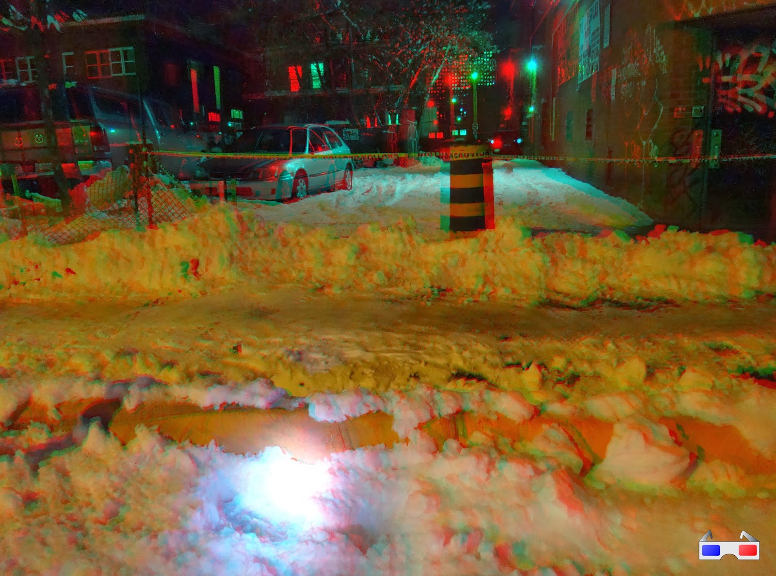
The following week, the road and sidewalks were stripped of the snow and graded with asphalt. It was probably the least snowy street in Ottawa (even if it was also the least-paved one). This excavator has a neat side-to-side pivot on its bucket.

Source photos for the 3D image: Left, Right

The sidewalks have been paved in asphalt temporarily for the winter, using this miniature asphalt layer vehicle (like the ones used for roads, but only about six feet wide). This might be my first attempt at nighttime 3D photos with flash, and I'm glad with how it turned out.

Source photos for the 3D image: Left, Right

The remaining three blocks between Bank and Cartier will be done next year, as will the finishing work on this block. It'll be a big improvement over how it used to look: an excessively wide street with no trees, lots of potholes, and narrow sidewalks.

[Tune in on Thursdays at noon for a new 3D image. View the 3D label for other posts with 3D images. 3D FAQ]

Monday, June 3, 2013

Google Charles View

Google Street View first launched in Ottawa in October 2009, using photos taken in the spring of that year.

In summer of 2012, they came back to take more photos, and these started to go live this past winter. This time around they used branded cars so you knew they were Google Street view. I saw them a few times myself, like here on Wellington Street in late April 2012:


When you view that location in Street View, it does say that the imagery is from April 2012, but clearly from a different day since the weather and traffic are both different.

However, there were some other spots where I saw (and hastily photographed) the Google Street View car where the corresponding images also captured me. Here's the Google Street View car on Gladstone Avenue at Bell Street:


And here's the corresponding photo of me in Street View, a few seconds before I noticed the Google car was there:


Here's another sighting, on Kent Street around Gloucester and Laurier on a mid-April morning in 2012. I had chased it for a couple blocks, tying to get close enough to photograph it. The only two photos I did manage to get are pretty blurry:


I had to get to work, though, and it caught a photo of me peeling off at the Laurier Segregated Bike Lane:


But by chasing it for a couple blocks, I had inadvertently managed to get my picture taken a number times by Google Street View.


It gets better: because I was chasing the Street View car but never quite catching up to it, when you click on the arrow in the above Street View shot to move the view south, I'm still in the same part of the frame for a number of shots until here:


Fun ;)

While we're on the topic of maps, check out the City's new GeoOttawa Maps. These replace the less-user-friendly eMaps, and have a number of new features, including:
  • Click "I want to..." at the top and then "View the historical air photos" to see aerials of Ottawa as far back as 1958! (Some of which were used by the URBSite author for this recent post)
  • Click on a property to bring up a property report, including a link to the zoning for the site
  • Click the little yellow street view icon on the left above the zoom bar and then click a spot on the map to go straight to that location in Google Street View (although it takes you to a limited-feature version of Google Street View hosted by the City)

Thursday, May 9, 2013

3D Thursday: 1966 Batmobile at Ottawa City Hall in 3D

This mornming, the Batmobile is visiting City Hall as a publicity stunt for Ottawa Comicon, and will be at Marion Dewar Plaza at 11:45am. I grabbed a 3D shot of it as it was being prepared for its appearance. Click for full size:


I also tweeted a photo of four By-Law officers (including a By-Law supervisor) eyeing the car, but none of them were up to giving it a parking ticket.
[Tune in on Thursdays at noon for a new 3D image. View the 3D label for other posts with 3D images. 3D FAQ] [Look for more one-photo posts under the label Singles]

Monday, May 6, 2013

Cruising on Elgin

The Ottawa Police Service has new cruisers, based on the Ford Taurus, rather than the familiar Ford Crown Victoria, which has been discontinued. As reported by the Citizen, these were released in February, after a technical hiccup.

Here's one heading up Elgin Street in front of the former Elgin Theatre (now Harvey's, Quizno's, and Johnny Farina)


Back last July, the Ottawa Sun wrote about the new cruisers, and a video on their article gives a tour of some of the features inside.

[Look for more one-photo posts under the label Singles]

Monday, April 15, 2013

Bixi's back for 2013

As of today, Capital Bixi is back in action! For subscribers like me, that means my key should work for the remainder of my one-year subscription (which I bought last June). And for you readers of my blog, that means I'm going to blog about it!


I never got around to blogging my Bixi photos last year (and the year before, my season-opener blog post used photos from the 2009 pilot), so I get to include some of those with this post. For example, the one above was taken last June at the Museum of Nature's east lawn, at Elgin and McLeod. On Saturday night, the bikes had been re-installed, though it was decidedly snowier:

Wednesday, June 20, 2012

Peds on Weds: Don't crack me up

I get very irate by people parking on the sidewalks (and I have many photos of such transgressions, which I tag with "vanscaping"). A majority of the time, they are blocking off the entire sidewalk (or enough that a stroller or wheelchair couldn't get through), when if they had parked entirely on the road there would have still been plenty of space for cars to get past. A case in point is this van on Gilmour at O'Connor.

But another reason is that sidewalks are only reinforced where there is a curb depression--i.e. where it is expected that cars will drive over them (with some exceptions like sidewalks over a bridge). Otherwise, for the post part, they are straight-up poured concrete.

Back in the winter, Eric posted at West Side Action about cracked sidewalks on Preston, likely from trucks having driven and/or parked on the sidewalk. In the photo above, a contractor's van is parked on the sidewalk, and the van's right tires correspond rather conveniently with the cracks down the middle of the sidewalk.

Individually, people who park on the sidewalk think that they are doing no harm. But collectively, as many people vehicles are parked on the sidewalk over time, the sidewalk breaks down and needs expensive and time-consuming repair. In the meantime, they are harder to keep clear of snow, and water that seeps into the cracks worsens the problem during the annual freeze-thaw cycles.

[Look for more one-photo posts under the label Singles]

Monday, April 30, 2012

Somerset Street Reconstruction Part 13: O-Train Pathway — Cantilevered Boardwalk

This is part 13 in the 15-part series on last year's reconstruction of Somerset Street West. Last time, I showed the construction of the tunnel that was built under the Somerset Street viaduct for the O-Train pathway.

In order to retain pedestrian connectivity while Somerset was completely dug up, a temporary boardwalk was installed off the side of the viaduct.

The bridge's railings were temporarily removed to provide access. You can see the oval-shaped railings sitting on the sidewalk here, with some connecting pieces standing on their ends in a couple of piles:

The mere removal of the railings—in another context—was a significant behind-the-scenes controversy in its own right, which I'll cover in the next post in the series.

While the boardwalk was being prepared, and before the hole was excavated, pedestrians crossing the bridge were directed by two rows of fencing to the middle of the roadway, which was closed to cars.

Friday, April 27, 2012

Somerset Street Reconstruction Part 12: Buliding the O-Train Pathway Tunnel

This is part 12 in the 15-part series on last year's reconstruction of Somerset Street West. In the previous post I described the planning behind the pathway that will go along the O-Train corridor (to be called the Champagne Pathway, I've just learned). Today I'll show the construction of the tunnel that had to be installed under Somerset to make this pathway happen. Eric Darwin of West Side Action blogged frequently during this construction process and I've included links to his relevant posts at the appropriate points.

Monday, March 19, 2012

Somerset Street Reconstruction Part 6: Poles and signals

Here's part 6 of the 15-part series on the reconstruction of Somerset Street West. In the previous part, we looked at the reconstruction of the roadway along Somerset between Booth and Preston. This time, we'll take a look at the traffic signals and hydro poles in the same stretch.

You'll note that the longer posts are now shortened on the summary pages. You can read more about that here.

Most of the photos in this post were taken in the winter, after Eric Darwin pointed out some concerns with the traffic signal pole design on his blog, West Side Action. I took this one, showing a carefully choreographed dance between two cherry pickers at Somerset and LeBreton, in mid-February.

Even though this is a couple of blocks east of the project limits at Booth Street, it looks like the opportunity was taken to replace some of the other streetposts that had been chipped away by years of snowplows edging past.

Wednesday, March 7, 2012

Peds on Weds: Ice away!

Even when no snow has fallen in a while, the City's road crews are still hard at work. This is something I've noticed a lot of this year that I don't recall seeing in previous years. The sidewalk plows are out in full force to clear built up snow and ice from the sidewalks and lay down salt on icy parts of sidewalks, especially at the corners. Not just the main streets, but side streets like Florence Street here have gotten this treatment—important when half of Centretown residents walk to work.

This is good news for pedestrians. There are plenty of things for pedestrians to complain about, but it's equally important to point out when good things happen to pedestrians. Please send me your ideas for positive pedestrian stories to include in my weekly Peds on Weds posts!

[Look for more one-photo posts under the label Singles]

Friday, February 24, 2012

Snow Removal on Kent

One night back in January, I happened upon a snow removal crew on Kent Street. I had a few minutes to spare, so I stuck around to watch and take photos. It's quite a feat of choreography, which happens several times each winter on Centretown's main roads, and at least once or twice per winter on our narrow side streets, too. With a decent snowstorm forecast, today seems like a good time to post these photos.

A day or so prior to the snow removal, temporary signs are stuck into the snowbanks prohibiting parking between 7pm and 7am (or 7am and 7pm). Right before the crews come by, a truck will collect most of these signs for re-use.

The process documented here, which spans about 20 minutes, starts with a loader, which moves much the snow away from the larger surfaces along the curb. All of this happens while traffic continues to flow, although since it's generally done in the middle of the night, the traffic is light.

A smaller plow goes around after the loader to get snow out of the smaller corners on the sidewalks. In the foreground, a coating of ice on the hydro pole cast a neat reflection of the light.

Friday, January 27, 2012

CfSC's winter parade

This past Sunday, Citizens for Safe Cycling organized Ottawa's first winter bike parade. Many others have posted their photos and writeups already, and I've put links to those at the end of this post.

The cyclists gathered at the snowed-over community garden along Laurier at Percy Street. It was encouraging just getting there, as there were three other cyclists in the bike lane on Bay Street as I was heading up.

Wednesday, January 25, 2012

Two minutes in the snow

The day after a big snowstorm, the city's winter overnight parking restriction is lifted, but there's still lots of snow on the side streets that needs to be pushed aside. Already narrowed by the previous storm's snowbanks, parked cars make the streets awfully narrow. Gilmour, seen here just east of Bay Street, is a one-way street, but even on the two-way streets east of Elgin opposing cars have to pull over to allow each other to pass.

The snowplow above was already stopped when I got there at 2:46 p.m., and two minutes later, it was almost done manoeuvring around that first car. Despite the size of the machine, the grader operator delicately cleared the snow around the car.

Now he just needs to get past the rest of the cars on the block!

Saturday, August 15, 2009

TD Bank throwback

Back in June, MM and I were standing on Elgin Street at Somerset, remarking at the 100-year-old sidewalk.

We were looking across the street at the current TD Canada Trust bank branch and noticing that it, too, has signs of where its exterior deposit slot had been replaced and painted over on the South end of the Elgin street wall.

I stood there contemplating how best to capture this in an image, when serendipity strikes and I get one chance to capture it as this old convertible drives through the frame:

Mission accomplished!

[I'll be posting more of these one-photo posts. Look for them under the label Singles]