Showing posts with label O-Train. Show all posts

Thursday, December 29, 2022

Wellington Street Part 10: Nepean Bay and the Ottawa River Parkway

Part 10: Nepean Bay and the Ottawa River Parkway

   [Show/Hide Contents]

In the previous post, we talked about the peripheral effects on Wellington street from the Garden of the Provinces construction, the LeBreton Flats expropriations, and the lowering of the C.P.R. Prescott Subdivision (all NCC projects).

Today's post will look at the Ottawa River Parkway, whose history is not well documented insofar as it affects Wellington Street. We're still in the 1960s, prior to the breakup of Wellington at the viaduct covered in part 8.

To get us situated, this colour photo from the early 1960s shows Wellington Street winding up from the bottom of the photo up across the viaduct, through LeBreton Flats, and into downtown:1

Colour aerial photo of LeBreton Flats, Bayview, and Nepean Bay before removal of railroad infrastructure and before expropriation of LeBreton Flats. Wellington Street viaduct, O'Keefe brewery, railyards tracks roundhouse, Chaudière Victoria Albert islands, Ottawa River. Somerset viaduct.

Monday, January 24, 2022

Wellington Street Part 9: The NCC's distractions (early-mid 1960s)

Part 9: The NCC's distractions (early-mid 1960s)

   [Show/Hide Contents]

In the previous part of this series about the renamings, connections, and disconnections of Wellington Street, we looked at the Ottawa Journal campaign leading up to the August 1969 viaduct transplant that broke Wellington Street apart over the tracks to connect with Scott. Today we'll skip back a few years now to look at what the NCC was up to around Wellington Street in the early 1960s.

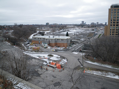
December 2012. Looking from the park atop the cliff at Bronson and Sparks down to LeBreton Flats including old Wellington Street, Pooley's Bridge, and Fleet street. Water pumping station is undergoing repairs. Condos south of Fleet not yet started construction. Transitway, no Booth Street bridge yet. A light dusting of snow.

Saturday, February 3, 2018

That time I was on the Skate Patrol for ten years (Part 1)

The 40th edition of Ottawa's Winterlude festival has opened this weekend, and its crown jewel, the Rideau Canal Skateway, is enjoying a good season. This year has had the earliest start in four years, after a record short 18 skating days in 2016 and 25 skating days in 2017.

The official @NCC_Skateway Twitter account often posts tidbits about the skateway, for example, a tweet mentioning that there is a team of 60 skate patrollers on the canal.

As it happens, I served on the Rideau Canal Skate Patrol for ten years, and I've been meaning to write about it. Now that I've been off the patrol for a while, it's time for me to come out of the shadows...

Wednesday, April 30, 2014

Jane's Walk Ottawa 2014 this weekend

This weekend (May 3-4, 2014) is the annual Jane's Walk Ottawa series of free urbanist walking tours, and as with last year, I'm publishing a list of walks in Somerset Ward.

I mentioned two of the walks I went on last year in my blog posts The Lonely Elm (Dennis van Staalduinen's walk on Wellington Street, who this year is giving a walk in Champlain Park) and The stones don't fall far from the hill (Quentin Gall's talk on Ottawa's Building and Monument Stones), both of which seem to have been one-offs.

Here's the rundown of Jane's Walks in Centretown for this year:

Monday, January 6, 2014

The stones don't fall far from the Hill

The Confederation building (1927) and Justice building (1935) on Wellington Street just west of Parliament Hill nicely frame the original Bank of Canada building (1937) on the south side of the street when you look south from Vittoria Street.


In this space used to be a number of stone carvings from the parliament buildings, including these two top-pieces from the stonework along Wellington Street in front of Parliament Hill. The photo above and the two below were taken on Victoria Day, 2009:

Thursday, September 19, 2013

3D Thursday: Darkness

Back in mid-May, before the finishing touches were done on the O-Train pathway, I swung by at night and took some photos. I had my tripod with me and some time, so I thought I'd see if I could get the right shots for some 3D photos. I think they turned out pretty well.

This one is of the stairs leading down to Louisa Street off the pathway. The railing had just been installed: (click on the image to see it larger, you can even make out the depth of the blades of grass!)

Source photos for the 3D image: Left, Right

When you're using one camera to take two exposures for a 3D shot, it's difficult enough in the daytime. The colours or lighting levels don't always match, you need to make sure the subject is stationary, and that the camera location is moved enough to have an effect, but not too much to spoil it. At nighttime, it's even harder. Night photos all but demand a tripod, and my point-and-shoot cameras aren't always consistent in producing the same settings for the same shot.

At the time, they were making rapid progress on installing the ramp in the sidewalk along the Somerset Street viaduct where the pathway comes uphill to meet it, so that cyclists could safely cross the sidewalk. They had left it for the night with the rebar installed and a fence segment laid over it, for safety I guess. This provides a great contrast of depths that works really well in 3D photos.

Source photos for the 3D image: Left, Right

While I wanted to come back to take a 3D photo the next day, I knew that there was a good chance they'd have poured the concrete, so I went ahead and poked my camera through the construction fence, held it still as best as I could, and took a photo. Then I poked it through the next hole over and did it again. And it turned out pretty good!

As it happened, I had to go by there anyway the next day, and they hadn't yet poured the concrete! But it was a good thing I had taken the photo the night before as I was in a hurry and could only snap a quick photo or two from across the street:


I hope you're enjoying the O-Train pathway, especially now that the O-Train is back in service!

[Tune in on Thursdays at noon for a new 3D image. View the 3D label for other posts with 3D images. 3D FAQ]

Monday, October 15, 2012

Prince of Wales rail bridge

I've been out of town working at a conference, and am even further behind in my blogging and photo-sorting than when I left. So here's a quick blog post to get me started again:

Here is the Prince of Wales railway bridge, silhouetted by a recent sunset with the Ottawa River rippling in the foreground. It connects Ottawa and Gatineau, Ontario and Québec, with Lemieux Island partway along.


As you probably know, this is at the north end of the O-Train line. There is a pathway currently under construction that will run along the O-Train line to connect the Ottawa River Parkway to Dow's Lake, effectively closing the pathway loop for pedestrians and cyclists. When complete, the pathway will have the Prince of Wales bridge on the north end, and Prince of Wales drive at the other end.

[Look for more one-photo posts under the label Singles]

Monday, May 21, 2012

Somerset Street Reconstruction Part 15: Finale - decorations and art

After a couple of months and 15 posts, we have come to the final part in the 15-part series documenting the reconstruction of Somerset Street West from the O-Train tracks, to Preston Street, and onward up into Chinatown to Booth Street.

This final post looks at the decorative and artistic elements of the reconstruction, including the four different street lamp designs, the public art component, and a few other artistic flourishes. This is over and above the previous posts that looked at the design of the sidewalks through Chinatown and the trees and bike racks.

The artistic theme is fitting, since the annual Chinatown Remixed art festival, which displays artwork in many establishments along Somerset Street from May 12 to June 12. I'll start off with some guerilla art that was installed on a street post sometime late last year. Flattened food and drink cans were attached to the post, effectively plating it in pop-art metal:

Getting back to the officially-sanctioned art, here are the old Chinatown lanterns that were installed 15-25 years ago with federal funding. At certain points, like in front of the Wah Shing store at Rochester here, these three-lantern posts were used:

All the lanterns between Booth and Preston will be replaced with the new design that debuted at the Chinatown Gateway Arch, minus the spotlights shown here on the ones surrounding the arch:

Monday, April 30, 2012

Somerset Street Reconstruction Part 13: O-Train Pathway — Cantilevered Boardwalk

This is part 13 in the 15-part series on last year's reconstruction of Somerset Street West. Last time, I showed the construction of the tunnel that was built under the Somerset Street viaduct for the O-Train pathway.

In order to retain pedestrian connectivity while Somerset was completely dug up, a temporary boardwalk was installed off the side of the viaduct.

The bridge's railings were temporarily removed to provide access. You can see the oval-shaped railings sitting on the sidewalk here, with some connecting pieces standing on their ends in a couple of piles:

The mere removal of the railings—in another context—was a significant behind-the-scenes controversy in its own right, which I'll cover in the next post in the series.

While the boardwalk was being prepared, and before the hole was excavated, pedestrians crossing the bridge were directed by two rows of fencing to the middle of the roadway, which was closed to cars.

Friday, April 27, 2012

Somerset Street Reconstruction Part 12: Buliding the O-Train Pathway Tunnel

This is part 12 in the 15-part series on last year's reconstruction of Somerset Street West. In the previous post I described the planning behind the pathway that will go along the O-Train corridor (to be called the Champagne Pathway, I've just learned). Today I'll show the construction of the tunnel that had to be installed under Somerset to make this pathway happen. Eric Darwin of West Side Action blogged frequently during this construction process and I've included links to his relevant posts at the appropriate points.

Monday, April 16, 2012

Somerset Street Reconstruction Part 11: Planning the O-Train Pathway

In the previous part of the 15-part series on the reconstruction of Somerset Street West, we looked at the City Centre complex, shown here with one of the many piles of garbage scattered behind the building.

The City Centre's connection to the Somerset Street reconstruction has to do with the tunnel built under Somerset last year, which will connect a new pathway in an existing corridor between the City Centre building and the O-Train tracks. Here's that corridor from the Somerset Street bridge, looking North to Albert and Bayview station.

Monday, March 5, 2012

Somerset Street Reconstruction Part 1: Introduction/Overview

Last year, Somerset Street West was dug up between Booth Street and the far side of the bridge over the O-Train tracks (Just as Bronson will be this year north of the Queensway. There's an open house tonight at McNabb Community Centre at 6:30pm to talk about the construction phasing for Bronson). This is the first in a 15-post series detailing the reconstruction, from someone who was involved in the reconstruction from the very first committee meeting of a long, involved process. Shown here is one of the public open houses at the Plant Bath:

After sorting through hundreds of my photos from this construction project, I'm proud to present this saga in rich detail. I'll be posting one or two entries per week. Here's the roadmap:

Show/hide list of posts in this series

  • Part 1 (below): Introduction and overview
  • Part 2: West of Preston
  • Part 3: Wider sidewalks with unit pavers
  • Part 4: Under Chinatown (Booth to Preston)
  • Part 5: Aside — Rochester/Spruce sidewalk
  • Part 6: Poles & signals
  • Part 7: Trees & bike racks
  • Part 8: Bridge sidewalks A
  • Part 9: Bridge sidewalks B
  • Part 10: City Centre
  • Part 11: O-Train pathway — planning
  • Part 12: O-Train pathway — tunnel construction
  • Part 13: O-Train pathway — cantilevered boardwalk
  • Part 14: Bridge railings
  • Part 15: Finale - decorations and art

There were many other great photos and topics that didn't fit into the series that I intend to draw from subsequently. I did a similar series on the Bank Street reconstruction in 2009, though I wasn't involved in the planning part of that project. Other multi-part series can be found under the label Tours.

Now let's get this series started!

Part 1: Overview

Officially, this total reconstruction of Somerset Street consisted of phases 3 and 4 of the Wellington Street West reconstruction, which involved the reconstruction of Hintonburg's main street in the previous few years. Since Chinatown east of Booth was done a decade or so ago, these were the final sections in the reconstruction of the century-old water mains and sewers along Somerset and Wellington all the way from Elgin to Westboro.

Thursday, July 8, 2010

Wellington Street, meet Wellington Street

With the current debate on the suggestion renaming Wellington Street in front of Parliament Hill after Sir John A. Macdonald, lots of people are wondering why we've got two Wellington Streets.

We actually had three of them: the third was that stretch that connects Scott Street to Albert/Slater, a section that is now called Albert Street. As seen in the map below, this stretch in 1894 was called Richmond Road (because the road went to Richmond, Ontario), so that stretch has had at least four different names to it! (I'll talk more about this map further down)

At one point they were connected, technically just one Wellington Street--not two or three. The roadway connecting Albert Street in Lebreton Flats to Wellington Street in front of Parliament Hill is still there, off Commissioner Street, but little used. It has a sign advertising the sidewalk as a shared sidewalk for cyclists, presumably dating from when there was regular motor traffic along there. At the end of it is Wellington Street coming off the Portage bridge, with the Library and Archives Canada square in front of us:

Before Lebreton Flats was razed, there was a bridge over the O-Train tracks connecting the 'middle' Wellington Street to what is now known as Wellington Street West. Here's a photo of that bridge from the Gréber report, with the bridge crossing the image. Behind it, you can also see the Prince of Wales railway bridge over Lemieux Island to Gatineau.

A similar view today, taken from the Somerset Street bridge looking North (bonus glamour shot of the O-Train). Where the track turns right is where the track turns right in the above photo. All the other tracks and buildings have been removed:

The right-of-way for this bridge is still there, going along the North edge of the City Centre building. In the photo below, looking West-ish, the City Centre building is at the left. The O-Train tracks are ahead (not visible), and we can see straight down Wellington West in Hintonburg. After a few blocks, it connects with Somerset Street West.

This isn't very intuitive, because Scott Street connects pretty much in line with Wellington/Albert, doesn't it? Well, Ottawa--even downtown Ottawa--is an agglomeration of a bunch of small villages and neighbourhoods that sprouted up pretty independently. The 1894 street map above (taken from this post on URBSite) shows duplicate street names (like two perpendicular "Arthur"s just blocks apart), often named in different neighbourhoods for the same royalty. Even by this time, the disparate road networks were connected, but it has led to some pretty strange intersections (e.g. pretty much any street crossing Bronson).

How does this look big-picture? Well that bridge is on the right in this aerial photo from May 1960. At the left is Nepean Bay, which is much smaller today than it was at the time. If you were to superimpose the Transitway, Ottawa River Parkway and pathways onto this photo, they would go right through the water. This is because it was filled in in the 60's or 70's for various city-building projects. The fill used was landfill (i.e. garbage), which is one of the main reasons it's so hard to get anything built there.

Also visible in the photo is the old Canadian Pacific Roundhouse, Lebreton Flats pre-demolition, the temporary buildings on the site now occupied by the Library and Archives Canada, the Alexandra (interprovincial) bridge in the background and buildings pre-dating the Canadian Museum of Civilization, and various former and existing landmarks.

And all this to explain why we've got two Wellington Streets.

PS: Those who want to rename Wellington after Macdonald and/or Cartier should know that we've already got a street named after Macdonald, running parallel to Cartier in the Golden Triangle, between Somerset and Frank: [Edit: It is observed by a commenter that the capitalization of that street is incorrect.]