Sorry I haven't been posting for a while. In June and July I was busy with Bluesfest, and at the end of July I lost two months' worth of photos to a massive hard disk failure.
So that kind of set me back a bit. Plus: hey, it's summer! But as things return to 'normal' I figured I should try to get my blog schedule back on track. I'll start off easy.
Here's a photo of the north-west sector of Centretown (the first definition here), looking east on Nepean Street from the hill near Bronson Avenue. At the upper-right, you can see the biplane that is another sign of summer:
Straight ahead is Centennial Public School, which had 21 trees planted earlier this summer thanks to the CCCA's Trees & Greenspace Committee, which worked to get the City of Ottawa to plant them.
Beyond that is May Nickson Place, a red-brick Ottawa Community Housing highrise on Gloucester Street, which will be sandwiched by even taller condos under construction on either side (the tower crane is for 224 Lyon).
Beyond that is the steeple of St. Patrick's Basilica, which is flanked by two CCOC towers at 210 Gloucester and the corresponding address on Nepean. The sides of those buildings blend into the Place Bell behemoth at 160 Elgin Street, which also has two highrise developments under construction on either side, although these are across the street.
[Look for more one-photo posts under the label Singles]
Showing posts with label Nepean St. Show all posts
Monday, September 9, 2013
Wednesday, November 28, 2012
Peds on Weds: street trees as eye candy
View other posts on these topics:
Elgin,
Gardens,
Gloucester,
Louisa,
Metcalfe,
Nepean St,
Parks,
Pedestrians,
Planning and Development,
Preston,
Sidewalks,
Sky,
Trees
Street trees/urban trees improve the urban fabric and increase property values. The shade they provide in the summer softens the pedestrian experience.
These ideas are generally taken for granted among urban planney-types. It is these positive associations that get trees sprinkled into architectural drawings such as this one for the building under construction at 150 Elgin:
This little stand on Preston and Louisa, even without the blooms Eric found, make a pretty solid aesthetic case for landscaping over vanscaping.
More often, however, they go in looking like Charlie Brown's Christmas tree, like these three installed on Metcalfe back in 2010:
When the Garden of the Provinces and Territories was built in the early '60s, it too had tiny trees, as seen in this photo via Urbsite
Half a century on, these trees have grown considerably, giving the park a much different (though not necessarily worse) feel. The canopy provides a low green ceiling to the park, making it a more private and reflective space to appreciate the grass and water features.
Street trees have a harder time than those in parks or front yards, due to the smaller area of land for rain to fall into and the increased exposure to salt, but they do sometimes make it. This row is on the north side of Place Bell, 160 Elgin at Gloucester. At the far left you can just make out Grant House (Friday's) and the construction site for the 150 Elgin office tower, mentioned above. The tree canopy has grown higher than the artificial canopy surrounding the building, but there is still much light coming through.
Closer to Elgin, the trees are noticeably shorter. There may be many reasons for this, but I suspect the tower of 160 Elgin blocks a lot of sunlight, stunting their growth. (Indeed, you can see in Google Street View that the one at the Elgin end, which would get more morning sun, is taller)
On the Nepean Street side of Place Bell looking west toward Metcalfe, the story is a bit different. The condo towers at 18 and 22 Nepean Street block out much of the light that would fall on the North sidewalk, the awning blocks out the sky immediately above, and the tree canopy blocks out the sliver of sky that remains. At eye level, there's little sunlight, and nothing but concrete, bare glass, and tree trunk to look at. The view on the North side will soon resemble this as 150 Elgin climbs toward the sky.
While we can't remove the buildings that are already there, we can make sure that as new towers are built there is sufficient space between them to let light through. The 27-storey tower approved for 91 Nepean and its identical siblings at 70 Gloucester and 96 Nepean, were approved by City Council on lots barely wider than the towers themselves. That sets a nasty trend: if the lots next door are allowed to be built the same way, we'll have a wall of building as dark as the one across from Place Bell, only twice as tall and closer to the street. There are trees shown on the drawings for 96 Nepean, but this is mostly eye candy on the drawings; we (and the future residents of the building) would be lucky if anything green grows at all.
It's actually fairly impressive how well these rows of trees surrounding Place Bell have survived in what looks like such small plots of ground*. And that's not a bad thing—removing these trees would certainly make this scene even worse—but the trees were originally added to soften the view at eye level, and now that they have grown beyond that height, something else is needed to fill this role so that this stretch of sidewalk can be more hospitable again. Maybe not a Zen pond, but something.
For now, the trees on the opposite side of the street at 150 Elgin will probably have to suffice.
(*See the street tree-related posts in my series on the reconstruction projects for Bank Street and Somerset Street)
[Tune in on Wednesdays at noon for a new pedestrian-themed blog post. View the Pedestrians label for previous Peds on Weds posts]
These ideas are generally taken for granted among urban planney-types. It is these positive associations that get trees sprinkled into architectural drawings such as this one for the building under construction at 150 Elgin:
This little stand on Preston and Louisa, even without the blooms Eric found, make a pretty solid aesthetic case for landscaping over vanscaping.
More often, however, they go in looking like Charlie Brown's Christmas tree, like these three installed on Metcalfe back in 2010:
When the Garden of the Provinces and Territories was built in the early '60s, it too had tiny trees, as seen in this photo via Urbsite
Half a century on, these trees have grown considerably, giving the park a much different (though not necessarily worse) feel. The canopy provides a low green ceiling to the park, making it a more private and reflective space to appreciate the grass and water features.
Street trees have a harder time than those in parks or front yards, due to the smaller area of land for rain to fall into and the increased exposure to salt, but they do sometimes make it. This row is on the north side of Place Bell, 160 Elgin at Gloucester. At the far left you can just make out Grant House (Friday's) and the construction site for the 150 Elgin office tower, mentioned above. The tree canopy has grown higher than the artificial canopy surrounding the building, but there is still much light coming through.
Closer to Elgin, the trees are noticeably shorter. There may be many reasons for this, but I suspect the tower of 160 Elgin blocks a lot of sunlight, stunting their growth. (Indeed, you can see in Google Street View that the one at the Elgin end, which would get more morning sun, is taller)
On the Nepean Street side of Place Bell looking west toward Metcalfe, the story is a bit different. The condo towers at 18 and 22 Nepean Street block out much of the light that would fall on the North sidewalk, the awning blocks out the sky immediately above, and the tree canopy blocks out the sliver of sky that remains. At eye level, there's little sunlight, and nothing but concrete, bare glass, and tree trunk to look at. The view on the North side will soon resemble this as 150 Elgin climbs toward the sky.
While we can't remove the buildings that are already there, we can make sure that as new towers are built there is sufficient space between them to let light through. The 27-storey tower approved for 91 Nepean and its identical siblings at 70 Gloucester and 96 Nepean, were approved by City Council on lots barely wider than the towers themselves. That sets a nasty trend: if the lots next door are allowed to be built the same way, we'll have a wall of building as dark as the one across from Place Bell, only twice as tall and closer to the street. There are trees shown on the drawings for 96 Nepean, but this is mostly eye candy on the drawings; we (and the future residents of the building) would be lucky if anything green grows at all.
It's actually fairly impressive how well these rows of trees surrounding Place Bell have survived in what looks like such small plots of ground*. And that's not a bad thing—removing these trees would certainly make this scene even worse—but the trees were originally added to soften the view at eye level, and now that they have grown beyond that height, something else is needed to fill this role so that this stretch of sidewalk can be more hospitable again. Maybe not a Zen pond, but something.
For now, the trees on the opposite side of the street at 150 Elgin will probably have to suffice.
(*See the street tree-related posts in my series on the reconstruction projects for Bank Street and Somerset Street)
[Tune in on Wednesdays at noon for a new pedestrian-themed blog post. View the Pedestrians label for previous Peds on Weds posts]
Monday, February 21, 2011
Tuesday at City Hall: Tower on a postage stamp
View other posts on these topics:
CCCA,
Nepean St,
Planning and Development,
Zoning
On Tuesday morning, the City of Ottawa's Planning Committee will be Considering an application for a 27-storey tower on Nepean Street, on a tiny site the size of a postage stamp. I had hoped to write this up much sooner, but better late than never...
Back in December 2010, FoTenn consultants came to the Centretown Citizens Community Association's Planning & Development Review Committee to seek community input on a 27-storey building their client, Claridge, wants to build at 89-91 Nepean Street. Here's a map of the site:
That map is based on the map (PDF) in the Centretown Secondary Plan. The white area at the top is the Central Business District, outside Centretown. The pink area is the "mid-rise" zone, which was envisioned to max out at about 9 storeys. The brown area where this site sits is supposed to be a "transition zone" between the central area (which generally has tall buildings), and the mid-rise area to the south.
Here's 89 and 91 Nepean Street, looking North-Westish (assuming Nepean runs East-West on Ottawa's skewed grid), in April 2010. The grassy lot is 89 Nepean, and there is a gravel parking lot at 91 Nepean next to it. They're pretty small sites. One of them has a "for sale" sign, though I can't tell for sure which:
Back in December 2010, FoTenn consultants came to the Centretown Citizens Community Association's Planning & Development Review Committee to seek community input on a 27-storey building their client, Claridge, wants to build at 89-91 Nepean Street. Here's a map of the site:
That map is based on the map (PDF) in the Centretown Secondary Plan. The white area at the top is the Central Business District, outside Centretown. The pink area is the "mid-rise" zone, which was envisioned to max out at about 9 storeys. The brown area where this site sits is supposed to be a "transition zone" between the central area (which generally has tall buildings), and the mid-rise area to the south.Here's 89 and 91 Nepean Street, looking North-Westish (assuming Nepean runs East-West on Ottawa's skewed grid), in April 2010. The grassy lot is 89 Nepean, and there is a gravel parking lot at 91 Nepean next to it. They're pretty small sites. One of them has a "for sale" sign, though I can't tell for sure which:
Monday, December 20, 2010
Nagle House, 77 Gloucester
View other posts on these topics:
CCCA,
CHP,
Gloucester,
Nepean St,
Planning and Development,
Singles
This is Nagle House, at 77 Gloucester street, just West of Metcalfe. It is one block to the north of 89-91 Nepean, a pair of lots on which Claridge wants to build a 27-storey tower.
The heritage plaque on the house writes, "Thought to be the oldest house in Centretown, this house was built for Richard Nagle, a successful dealer in timber limits."
The Bytown Museum's Capital Neighbourhoods website lists little more about the house than is on the plaque.
A Google search for Richard Nagle brings up only a few more details. A web page listing Ancestors of Ryan Todd Morgan writes, "66. Richard NAGLE was born 1810 in Ireland and was baptized in Ireland. He died 1877 in Ottawa, Canada. Richard married Margaret MCCARTHY." The site says they had a child, Ann in Clare County, Ireland in 1832, who died in Kansas in 1920.
Another source he married Mary O-Brien in 1854, presumably after Margaret died in 1850.
As for 89-91 Nepean Street, it's pretty frightening what Claridge is asking for on that site. I'll spare the details here, but suffice it to say they're asking for a lot and offering nothing in return. For full details, check out the CCCA's letter to the City regarding this site. The letter includes a plethora of reasons why this application shouldn't be permitted, and Councillor Holmes' comments of a similar nature. This one will go to Planning Committee in the new year, but City staff are compiling their report on the application.
As the Ottawa Citizen writes in a recent editorial, intensification is good, but it needs to be done with a human face.
The CCCA's next regular board meeting is tomorrow, Tuesday, December 21, 2010 at 7pm at City Hall (Honeywell Room). All are welcome. There is a vacancy on the Board that will hopefully be filled at the meeting. Check the CCCA's home page for the agenda.
[Look for more one-photo posts under the label Singles]
The Bytown Museum's Capital Neighbourhoods website lists little more about the house than is on the plaque.
A Google search for Richard Nagle brings up only a few more details. A web page listing Ancestors of Ryan Todd Morgan writes, "66. Richard NAGLE was born 1810 in Ireland and was baptized in Ireland. He died 1877 in Ottawa, Canada. Richard married Margaret MCCARTHY." The site says they had a child, Ann in Clare County, Ireland in 1832, who died in Kansas in 1920.
Another source he married Mary O-Brien in 1854, presumably after Margaret died in 1850.
As for 89-91 Nepean Street, it's pretty frightening what Claridge is asking for on that site. I'll spare the details here, but suffice it to say they're asking for a lot and offering nothing in return. For full details, check out the CCCA's letter to the City regarding this site. The letter includes a plethora of reasons why this application shouldn't be permitted, and Councillor Holmes' comments of a similar nature. This one will go to Planning Committee in the new year, but City staff are compiling their report on the application.
As the Ottawa Citizen writes in a recent editorial, intensification is good, but it needs to be done with a human face.
The CCCA's next regular board meeting is tomorrow, Tuesday, December 21, 2010 at 7pm at City Hall (Honeywell Room). All are welcome. There is a vacancy on the Board that will hopefully be filled at the meeting. Check the CCCA's home page for the agenda.
[Look for more one-photo posts under the label Singles]
Tuesday, April 6, 2010
Bay and Nepean demo, part 5: 355 Nepean Street
View other posts on these topics:
Bay,
Demolition,
Nepean St
Today's post is the fifth in a series of posts on the houses demolished at Bay and Nepean. In the previous post in the series, I documented 357-359 Nepean Street.
Today we'll look at 355 Nepean Street, the second of the two houses on Nepean demolished in this group, and the last of the five profiled in this series (the sixth part of the series will come in a few weeks when the site is landscaped).
In this late November 2007 view of Nepean Street from Bay Street, the first two buildings are not being demolished, as they were not aquired by Richcraft. The next two houses are demolished.
Like so:
355 Nepean was a nice, red-brick single-family house. It appeared to be in impeccable condition, even after years of being empty. It was up close to its neighbour at 347-349 Nepean, which looked shorter and stubbier in contrast.
Its demolition was in progress on March 18. Here part of the side wall was still up, kitchen cupboards dangling from the wall. This side wall was so close to the neighbouring house, that the side-wall windows next door had been bricked up.
A couple days later, the rubble was still being cleared away. Here's a good shot of 357-359 Nepean, no longer overshadowed by its former neighbour.
355 Nepean had a small front porch, accessed from the driveway, on which sat a wood-and-wrought-iron bench. The bench had certainly seen better days, but surprisingly by late November 2007 it was still there.
By late May 2009 the bench had been removed, as had the screen wall behind it. The french door had lost a few of its panes.
And of course little of the porch was left after demolition. From this angle we see Queen Elizabeth Towers, foreshadowing the tall building to eventually be built on the site.
Along the side of the house, this small window at foundation level was barred up and some of the panes broken. More panes would be broken the following winter.
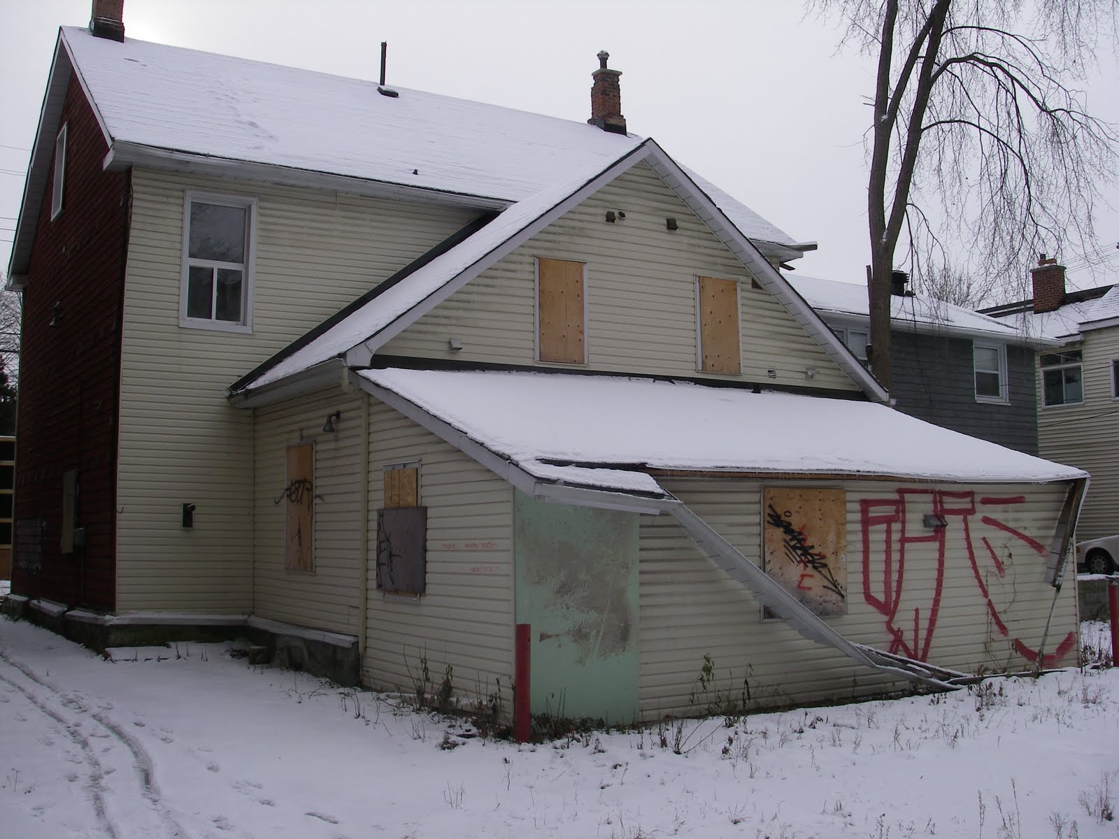
The back of the house was still in very good repair in late May 2009, so much so that it had largely avoided graffiti artists. The piles of dirt under the rear porch had been a recent addition.
The porch itself was a nice piece of architecture. I believe it was tall enough for cars to be parked underneath it.
A picnic bench had been built into the porch. A clever inclusion, I thought. There was also a second porch above the second balcony. This would definitely have been a wonderful house for spending time outside.
Completing the nature theme were vines completely enshrouding the front and side of the house. Obviously they've overgrown since the house was last occupied, but I couldn't help but be reminded of "Jumanji" by this scene.
That about rounds it up for the review of the houses. The next post in the series won't be for some weeks, when the landscaping is finished on the site.
In the meantime, check out the rest of the posts in this series, or some of the other series of posts under the label Tours.
Today we'll look at 355 Nepean Street, the second of the two houses on Nepean demolished in this group, and the last of the five profiled in this series (the sixth part of the series will come in a few weeks when the site is landscaped).
In this late November 2007 view of Nepean Street from Bay Street, the first two buildings are not being demolished, as they were not aquired by Richcraft. The next two houses are demolished.
In the meantime, check out the rest of the posts in this series, or some of the other series of posts under the label Tours.
Friday, April 2, 2010
Bay and Nepean Demo, Part 4: 357-359 Nepean Street
View other posts on these topics:
Bay,
Demolition,
Nepean St
Last time, I posted the third in a series of posts on the demolition of houses at Bay and Nepean. With the three Bay Street houses done, it's time to turn to Nepean Street.
The building on the left is not being demolished, and it has not been bought by Richcraft. It's a curious one itself, being constructed with a wide variety of bricks, including glass bricks in the second-storey window. But the building being profiled today, 357-359 Nepean Street, is the cream-coloured one next to it.
If you blinked, you might have missed it:
The house is described on URBSite as "A tight hipped roof double with modest Georgian proportions," dating from the late 1870's. Five electricity meters (suggesting the building was a four-unit rental) clutter up what little of the façade isn't occupied by windows and doors, in this late-November 2007 photo:
The demolition reveals to onlookers that there were two rooms in the basement.
At the front, again in late November 2007, we see a wooden porch with its white posts almost all broken away.
By the time I took this photo, a few days after the URBSite post, the utilities had been disconnected. Curiously, if you click on the photo to see it full size, you will notice that the word "You're" on the sign is actually a sticker, perhaps to correct a typo?
This building is just down the street, and is of the same vintage. Obviously, it's been much better kept: not only is it faced with brick, but there are windows on the sides. The foundation is also slightly taller, necessitating steps to the front porch.
There isn't much notable in the ways of windows on the sides of 357-359 Nepean, although there is a very narrow window at the foundation.
I didn't notice it until the house had been removed from on top of it. We're looking at the exposed inside wall of the same window.
Another detail is the chimney, which had lost some bricks years ago.
There's some yellow spray-painted graffiti on the front window here, but the fridge visible through the window gave me chills, like a ghostly reminder that this was once someone's living space.
The wood clapboard siding, painted in a dark red, had a nice texture to it. At each storey there were squares boards spaced at regular intervals.
The rear of the house was interesting, seen here in late November 2007. Two successively smaller additions were added at some points in the building's history. An eave at the very rear was only tenuously attached.
A year and a half later, not only had the snow gone from the roof, but bits of the roof itself were missing as well! The rumour I heard was that firefighters used the house to practise entry into older buildings, effectively sealing its fate to never be used again. As with the other houses, graffiti had been painted over with brownish paint.
That's it for this house, unfortunately. On the bright side, at least its better-kept sibling remains intact.
Make sure to catch the fifth post in four more days (Tuesday at noon) on the last of the five buildings demolished on this site. The sixth and last installment will come a bit later when landscaping has progressed, at which point I'll include photos of the site taken from above.
The building on the left is not being demolished, and it has not been bought by Richcraft. It's a curious one itself, being constructed with a wide variety of bricks, including glass bricks in the second-storey window. But the building being profiled today, 357-359 Nepean Street, is the cream-coloured one next to it.
Make sure to catch the fifth post in four more days (Tuesday at noon) on the last of the five buildings demolished on this site. The sixth and last installment will come a bit later when landscaping has progressed, at which point I'll include photos of the site taken from above.
Monday, March 29, 2010
Bay and Nepean Demo, Part 3: 259 Bay Street
View other posts on these topics:
Bay,
Demolition,
Graffiti,
Nepean St
[It seems there is a problem with the images. Update: the problem is on Google's end.]
Last time, I posted the second in a series of posts on the demolition of houses at Bay and Nepean. In that post, I looked at 255 Bay Street, on the left in the photo below taken in late November 2007.
Today, we'll look at 259 Bay Street. It is not a particularly spectacular house, and as a result this is the shortest post in the series.
As we can see in the photo below, it's a fairly ordinary house, but it does have quite a bit of character underneath the paint and graffiti. The sidewalk has been poured all the way to the foundation, but the window dressings, including shutters and eyelash-like brickwork, give it its charm.
Certainly more charming than a pile of rubble.
In the laneway, big rocks discourage motorists from using the laneway. Here in late May 2009, we see anti-Olympics graffiti on the side wall, reading "Rise Up / Resist / Riot 2010"
Removal of the rubble revealed graffiti in the basement, too.
At the rear, we see that the backyward had also been paved over, probably to save on landscaping costs. In May 2009, after a few years of human absence, we see nature beginning to reclaim its ground.
An architectural curiosity is the small window at the back of the house that was partially obstructed by the roofline of the rear addition. More photos of the rear of the building are in the previous post.
Here we see the rear foundation wall of the original building, with some holes in the middle for what I assume is a woodstove and flue.
Lastly, a foreshadowing of the next post. In the background of this late-November 2007 shot looking through the laneway between 255 and 259 Bay we see not only the tower crane for Hudson Park phase I (which was just reaching ground level at the time), but also the rears of the next two buildings in the series.
Tune in in four more days--Friday Noon, for Part 4: 357-359 Nepean Street.
Last time, I posted the second in a series of posts on the demolition of houses at Bay and Nepean. In that post, I looked at 255 Bay Street, on the left in the photo below taken in late November 2007.
As we can see in the photo below, it's a fairly ordinary house, but it does have quite a bit of character underneath the paint and graffiti. The sidewalk has been poured all the way to the foundation, but the window dressings, including shutters and eyelash-like brickwork, give it its charm.
An architectural curiosity is the small window at the back of the house that was partially obstructed by the roofline of the rear addition. More photos of the rear of the building are in the previous post.
Thursday, March 25, 2010
Bay and Nepean Demo, Part 2: 255 Bay Street
View other posts on these topics:
Bay,
Demolition,
Nepean St
Last time, I introduced the series on the demolition of the houses on Bay and Nepean, with a background on the reasons for demolition and a profile of the former building at 249-251 Bay Street.
Today we'll be looking at 255 Bay Street, the cream coloured one in the middle of the row between Gloucester and Nepean streets. I just noticed that in this photo, taken late May 2009, they still hadn't installed permanent signage for the speed humps that had been installed the previous November (the first photo of Part 1).
And a week ago, there wasn't much left--though there is a permanent speed hump sign now. The removal of these houses opens up a clear view of the hirises behind. You can see how the downtown hirises come down to twelve storeys South of Gloucester Street.
Here's a view of the front of the house, in late May 2009. It has a bit of a shoreside feel to it, ignoring the graffiti. There's a fire hydrant in the front yard.
Similar angle a week ago. It was nice of them to leave the bush there. The fencing skirts around the fire hydrant, giving lots of clearance on both sides.
Another view from the front, showing the dark plexiglas elements under the porch roof. A pigeon on the top of the roof adds to the seaside feel. Behind the steps, you can see the porch is supported by a poured concrete block.
There's that concrete block, in front of the pile of rubble.
Enough with the front, here's a shot of the rear of the building, with a tree stump in the foreground, in late May 2009 (The tree was not removed recently). If you look on the second storey, to the left of the door (presumably to a former addition), there is some exposed wall.
Here's a closeup of that exposed wall section. I can make out four or five layers: from bottom to top, wood slats, fake brick patterned tarpaper [Edit: Insulbrick, according to the Ottawa Velo blog. Also, I see some of my photos were out of order--Fixed!], more wood slats, covered by a wood frame with the outer layer of siding. A curious pigeon looks on from the top left.
Back in late November 2007, there was some graffiti on the back of the building, and whatever rear bits of the structure had already been removed.
By late May 2009, the graffiti had been unceremoniously painted over in ochre paint. You can see the large boulders placed in the driveway, presumably to prevent people from parking on the site. Behind the buildings are the two towers of the Bronson Place apartments, foreshadowing the tall structure to eventually rise on this site.
The building on the left is the next one in the series. Tune in four more days from now, on Monday, for Part 3: 259 Bay Street.
Today we'll be looking at 255 Bay Street, the cream coloured one in the middle of the row between Gloucester and Nepean streets. I just noticed that in this photo, taken late May 2009, they still hadn't installed permanent signage for the speed humps that had been installed the previous November (the first photo of Part 1).
Subscribe to:
Posts (Atom)
