Showing posts with label Bronson. Show all posts

Thursday, April 27, 2023

The skinny on sidewalk design in Ottawa

Thanks to the Ottawa Lookout, I learned that today at the City's Transportation Committee meeting, Councillor Shawn Menard has a motion in relation to an ongoing review of sidewalk designs.

Since I currently have a cold, I can't present in person, so instead I wrote out a presentation to Transportation Committee. I'm reformatting it here, as a more concise rewrite of my 2014 blog series about Ramp style sidewalks (or "Toronto-style sidewalks", as they were called then).

Sidewalk with house porchsteps on the left and grassy lawn on the right, with trees providing canopy cover (west side of Queen Elizabeth Drive near McLeod Street)

Wednesday, January 29, 2020

Wellington Street Part 5: Tinkering with traffic (1910s to 1940s)

   [Show/Hide Contents]


Let's continue with our journey exploring Wellington Street as the street was extended, renamed, and rerouted over its 200-year history. In today's post, we'll look at the many little clues that give us an idea of what traffic was like on Wellington Street from the 1910s to the mid 1940s.

During this time, Wellington street wasn't extended or curtailed, but traffic in the city got busier as more people drove automobiles and the City's response to this traffic problem had to mature to cope with it. To set the scene, here's LeBreton Flats from around 1930, with Wellington Street coming in from the left and winding up through to downtown:1

Black-and-white aerial photo taken from above Preston and Somerset with LeBreton Flats, Chaudière and Victoria Island, and Hull at left, and Somerset/Booth, Bronson/Laurier, and the Parliament buildings on the right. The Alexandra/Interprovincial bridge crosses the Ottawa River at the top. From the left near the bottom Wellington Street comes in and splits at Broad Street with Albert continuing straight and Wellington turning left at a shallow angle. On the north side of Wellington, west of Broad, is the Marine Signals building ('the longest in the British Empire') with trainyards and Nepean Bay beyond, and the blocks abutting Wellington on the South side are occupied by a few large industrial facilities. The other blocks further south are primarily residential.

Monday, March 10, 2014

An urban gas station in Centretown

The Petro Canada at Bronson and Somerset quietly reopened this past Friday after about six months of construction, which started shortly after the reopening of newly reconstructed Bronson Avenue. It comes complete with a convenience store at the corner, seen best at night in HDR.


Even though about three-quarters of Centretown residents walk, bus and bike as part of their regular commute to work and school, the car ownership rate in Centretown is about 1.3 cars per household. So when residents of Centretown, Chinatown and Dalhousie eventually have to fill their tanks, they have to go somewhere. After the closure of the Shell station at Gloucester, this station just on the far side of Centretown's Bronson border is one of the closest to downtown. (I'm not saying I regret the closure of the gas stations that used to pepper Centretown much more heavily!)

But just because a gas station is a car-oriented business, it doesn't mean it can't also fit into the fabric of a walkable urban neighbourhood. Before the construction photos, let's look at how the station used to look:

Wednesday, February 5, 2014

Peds on Weds: Part 4: A history of sidewalk design in Ottawa

Today for the fourth and final entry of the sidewalk-design series, I'm going to give a history of sidewalk design, starting at the establishment of the original City of Ottawa, in 1855 (and earlier!). In part 2 of this series, I already gave a "little history" of the Toronto-style sidewalk design, relating specifically to how they became standard back to the establishment of the current amalgamated City of Ottawa in 2001. This followed part 1, in which I described "Toronto-style" sidewalks and the problems they're meant to address, and part 3, in which I discussed some of the issues the Toronto-style sidewalk itself has faced.

Today's entry starts with the West Ward Market, built in 1848 by Nicholas Sparks. This was used as Ottawa's first City Hall, roughly where the NAC is today.

r

The first municipally-built sidewalks in Ottawa actually predate the City of Ottawa's 1855 incorporation: by-law number 37 of the Town of Bytown, approved the 23rd of September, 1850, was "To authorize the expenditure of £75 in making a Plank Sidewalk, S. side York Street":

Wednesday, January 29, 2014

Peds on Weds: Toronto-style sidewalks part 3 - the downsides

There has been a fair amount of criticism of the Toronto-style sidewalk design since it was made the standard in the City of Ottawa in 2006, just as there have been various challenges implementing it. As with any standard, you can't please all of the people all of the time, especially in a constrained physical environment like Delaware Avenue, below:


In the first part of this series, I described what "Toronto-style" sidewalks are and how they're supposed to work. In the second part, I detailed the rather technical history of how this sidewalk design, also known as "ramp-style vehicle access crossing", became standard, following through minutes from post-amalgamation City of Ottawa through to 2006.

Feedback about the design started as soon as the sidewalks on Delaware (pictured above) and Holland Avenue were installed for the pilot project. Since then, the design has also received its share of criticism from various sources. Today I'll be discussing these criticisms, and other issues the standard has encountered. I'll finish the series next week with a review of alternatives, starting with how Ottawa's sidewalks have been designed through the ages.

Wednesday, January 15, 2014

Peds on Weds: Toronto-style sidewalks part 2 - a little history

As promised, this week's Peds on Weds blog post continues the theme from last week's introduction to "Toronto-style" (or "ramp style") sidewalks, which, you will recall, are continuously flat with only the section nearest the curb ramping down to meet the curb at driveways, like so:


I'll be limiting this week's entry to how we got to this design, which unfortunately requires a lot of text from City meeting minutes (ahem, back when they had text minutes you could search and skim instead of audio recordings you need to pore over and transcribe). You'll have to wait for next week for the well-illustrated post about criticisms and issues with Toronto-style sidewalks, which you won't have to read in the same blog post as this largely technical post.

An interesting element of the story is that it starts in 2001, as the Transportation & Transit Committee for the first City Council for the newly-amalgamated City of Ottawa considered its very first budget (or in this case, reviewed the budget prepared by the Ottawa Transition Board).


2001:

The 2001 budget documents aren't online, but the minutes of the April 18, 2001 Transportation & Transit Committee budget meeting make reference to what is presumably a project to develop new sidewalk standards, and Councillor Clive Doucet moves a motion to delay sidewalk projects until the standards are written:

Wednesday, January 8, 2014

Peds on Weds: Toronto-style sidewalks part 1

For quite some time now, I've wanted to do a thorough writeup on what in Ottawa traffic-geek circles is referred to a "Toronto-style" sidewalk design. People love them and hate them, for reasons that I'll discuss over the next three weekly pedestrian-themed "Peds on Weds" posts, starting here.

The sidewalk seen below is an outstanding example of what people I know call a "Toronto-style sidewalk". I've no idea what people in Toronto call them, and for all I know the title might be apocryphal. The term refers to is a wide, flat surface for pedestrians, and the crosspath is ramped only to the minimum extent required for motor vehicles to get up to the height. This example is on the east side of Bronson looking north from Somerset to Cooper Street in August 2013, not long after it was installed. Pardon the spray paint markings:


The benefit is for pedestrians, but this is anathema to the car-centric roadbuilders who install them, as Eric Darwin described in a West Side Action post about the installation of the sidewalks on Bronson:
"I talked to the project / concrete foreman on the site [Bronson west side, north of Gladstone]. I complimented him on keeping so much of the walkway level. He, however, was much more interested in pointing out how gentle the motorists’ slopes were, so there wouldn’t be much of  bump for them."
The ramp is what gives the design its official name in the City of Ottawa, which has been the official standard in the City of Ottawa since June 2006: the "Ramp Style Vehicle Access Crossing" (being a traffic department term, naturally the title refers to its relationship to vehicles rather than to pedestrians or sidewalks). There is a gradual 2% grade over the flat part of the sidewalk to drain water away from the road (2% is not as steep as depicted here) which must be at least 1.05 m wide, and the ramp is 75 cm wide, assuming a curb height of 12.5 cm:

Monday, November 18, 2013

Bad sectors in Centretown

Back in July, my hard disk drive crashed, losing two months' worth of photos (about 1600). At the end of October I got a surprise call from the guy I'd brought it to, who said he was able to recover over 90% of the data. I was able to push this to about 97% of the photos that I had taken since my previous backup.

Some of them, however, were damaged. The hard drive had bad sectors and in the recovery many of the photos were damaged (only a very small number were completely unreadable). The damage inflicted on them actually has a bit of an artistic tone to them. Here's a photo of 222 Queen Street (which is where the RMOC headquarters were before it moved to the building that's now City Hall):


I discovered that I actually had a more recent backup on an external drive, up to mid-June. From this, I was able to push the recovery rate to about 99% of my photos, since many of the damaged photos were taken before then. Here's the original of the photo above:

Monday, September 30, 2013

Bronson reopens for the last time

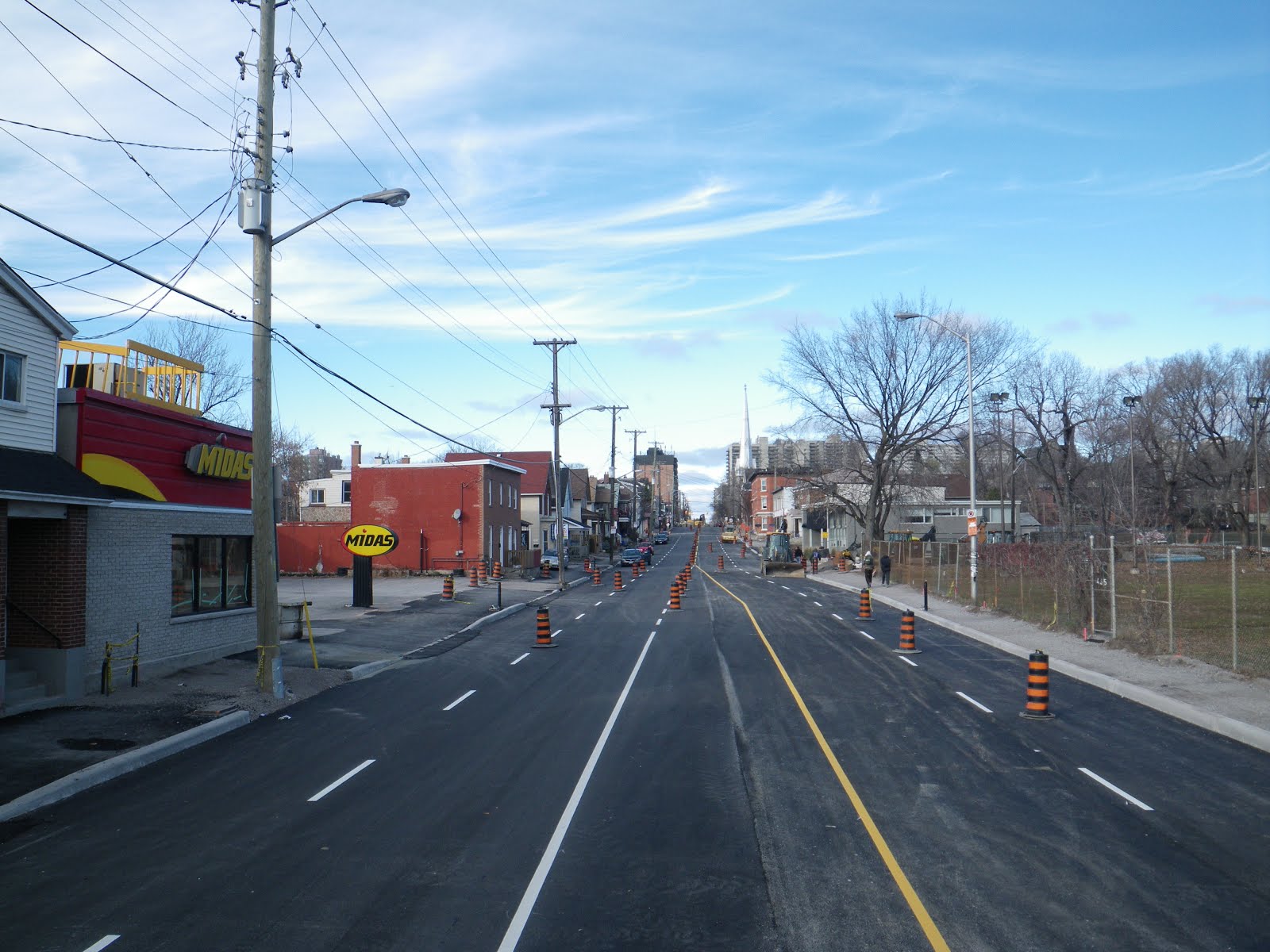
After two years of construction, Bronson Avenue reopens to through traffic today, whereas it had been closed between Laurier and Somerset (the headline of the linked PSA wrongly states Gladstone). I thought I'd post some snapshots to summarize the progress.


As with last year, the reopening isn't necessarily something to celebrate, as Bronson will no doubt return to its status as a traffic sewer for hasty drivers with little or no connection to Centretown, the roadway is the same width as before the reconstruction (despite the Community's strong desire to get it rebuilt otherwise), but without all the potholes to slow them down. There will hopefully be some degree of relief on the side streets which have been host to cut-through traffic when Bronson was closed.

Recall how disruptive the closure was to road users of all modes. Not only did it disrupt the patterns of people who were just passing through, but when the intersection of Somerset and Bronson was closed, bus riders had quite a walk to get to the nearest bus stop. Customer traffic to the businesses along Bronson slowed to a trickle when Gladstone was closed. There were some attempts to maintain temporary sidewalks for pedestrians also, as seen here in the muddy mess of a street, looking north along the former east sidewalk:

Thursday, July 25, 2013

Yellow dots are like loopy buttons for cyclists

(It's been a month since my last post; I'm slowly recovering from a long stint volunteering at RBC Royal Bank Bluesfest where I run the bike parking. This year we had record numbers again!)

A topic I'm eager to write about is the yellow dots on the pavement at intersections. You may recall my epic on pedestrian buttons, No Ifs, Ands or Buttons (and the follow-up supplementary post). Well cyclists have a way of activating the signals too, and what better place to describe it than the brand-new traffic control signal at Bronson and Arlington:


To recap the lowdown on ped buttons: when there is a traffic control signal with buttons, and there is a little yellow sign above the button, that means you must press the button if you want the walk signal to activate (though for some such intersections there might be some times of the day or week when the signal changes on a fixed timing whether or not the button is pressed).

Monday, May 13, 2013

Bronson and Somerset still closed

Construction on Bronson Avenue resumed a while ago, with the Somerset and Bronson intersection closed from the beginning of April to the end of May. Other work has also been going on, such as the finishing touches of the segment south of Somerset, in particular the sidewalks and landscaping between MacLaren and Gladstone (which Eric Darwin has recently blogged about). The impact on Chinatown can be expressed in this single photo:


This next picture gives a bit of an idea of why the intersection has to be closed for so long. There's a mess of stuff underneath that needs to be replaced. It's a three-dimensional soup of cables, wires, pipes, drains, and sewers (much of the latter were installed late last year and over the winter).

Friday, May 3, 2013

Jane's Walks this weekend!

In case you haven't heard, Jane's Walk Ottawa happens this weekend. I haven't given any since the Rescue Bronson Jane's Walk I gave two years ago. It was fun, but a lot of work. So instead I'll try to go out on a couple of other people's walks. Here are some I'm looking at that are within Somerset Ward, with the description on the Jane's Walk Ottawa website linked to the headings:

Apt613 Blog Walk of Somerset
Saturday, May 4, 2013, 2pm-3:30pm
Meet at Dundonald Park, Somerset and Bay

Staying on the Bronson theme of my 2011 walk, Apartment 613 is holding a walk in Chinatown, whose businesses are suffering from the closure of the Bronson/Somerset intersection. This one has a neat format, where they'll interview some of the business owners in the same way they do interviews for their blog entries, only it'll be live and you'll be there!


Local Confectionaries
Saturday, May 4, 2013, 4pm-5pm
Meet at Somerset and Preston

A great segue from the Apt613 walk, local cartoonist/illustrator Colin White is giving a tour of the corner stores which feature often in his drawings. I don't think I've met him in person, but I like his depictions of familiar hyperlocal landmarks.

Monday, December 17, 2012

Bronson's Back

Bronson is reopening to motorized traffic for the winter at 9am this morning, ending the short period where pedestrians had the whole road to walk over.


Construction will resume next year.

On the bright side, businesses will have their passing customers back, and residents on detour routes (formal and informal) will have less traffic in front of them.

[Look for more one-photo posts under the label Singles]

Thursday, November 29, 2012

3D Thursday: Bronson Avenue artwork chosen

The artwork for the Bronson Avenue reconstruction project has been selected. Instead of having a series of smaller artpieces along the sidewalk, like Bank (Centretown), Bank (Glebe), Preston, Somerset, King Edward, and perhaps most (in)famously, Wellington Steet West, Bronson Avenue's art budget was pooled to create two larger installations.

There was an open house earlier in November where members of the public could provide feedback to the review panel, and around that time Lana blogged about the locations: on top of the entrance at the Bronson Centre, and along the fence at McNabb.

Tim desClouds' wonderful piece, Sit for a While, In the Garden, and Watch the Parade, will run along Bronson Avenue near Gladstone where the Lawn Bowling club is now. It includes a giant layered tree on a fence with cutout figurines. The fence pickets will be bent to create seating inside the fence itself.


Tim is the person who did the chairs along Bank Street in the Glebe, and he actually submitted a piece for the other Bronson artpiece location along similar lines.

I actually did a second version of the 3D photo with different adjustments. It's difficult at such close range to get everything in 'focus'. If you like, you can download the source photos and try yourself (search YouTube for tutorials to make 3D pictures)


Source photos for the 3D images: Left, Right

For reference, the fence would replace the old one on the right here, a bit further back from the curb (this photo was taken on Sunday):


For the other artpiece location, Andrew O'Malley's piece, Community Channel, was selected. It involves a number of aluminium and acrylic figures on top of the Bronson Centre's entrance which, for the first few months at least, will be illuminated in changing colours.

I say "for the first few months" because light-based artwork doesn't last long and there is never any money for its maintenance—the sound-based piece at City Hall's Laurier entrance has been broken for a decade and won't be fixed anytime soon.


The other submissions—all moot now—were summarized at the time by Eric Darwin on West Side Action and by the Ottawa Citizen.
[Tune in on Thursdays at noon for a new 3D image. View the 3D label for other posts with 3D images]

Wednesday, October 17, 2012

Peds on Weds: Juliana sidewalk replacement

This hill on Bronson Avenue is looking south from Queen Street to Albert (where the bus is going), across to Slater and up Nanny Goat Hill to Laurier. In the immediate foreground on the right is 100 Bronson, the Juilana Apartments, built on the site of Henry Bronson's mansion in the 1960s by Douglass and Ross, as described in the latter part of this URBSite post.

I'm more interested in the sidewalk in front of the luxury apartment building. The little white arrows are telltale signs that those broken concrete squares of sidewalk will soon be replaced.

Looking north from Albert Street, back in the other direction, we see the other end of the imminent repairs. The white arrows were added in early August.


In late September, the City replaced the concrete sidewalk. It wasn't done all in one pour, there was some left at the Albert Street end of the stretch when I stopped by:

The stretch of sidewalk that was replaced only extended as far as the stairs to the apartment building.

That black patch of asphalt was actually put there not by the City but by Enbridge, which also put down that square of asphalt across the street after some work they did in the roadway. Since Enbridge dug it up, it's up to Enbridge—not the City—to replace it.


On the one hand, it's unfortunate that the sidewalk couldn't have all been replaced in one go by whomever got there first, but all told this is probably the simplest way. An alternative would have the City paying to reinstall the sidewalk that Enbridge dug up, and either footing the bill (at the expense of other needed sidewalk projects) or administering the paperwork to pass the bill along to Enbridge.

In the end, the broken section of sidewalk will have been replaced and that's what really matters.

[Tune in on Wednesdays at noon for a new pedestrian-themed blog post. View the Pedestrians label for previous Peds on Weds posts]

Thursday, September 6, 2012

3D Thursday: Bronson press event

A couple weeks ago, the City's Infrastructure Services Department held a press event whereby they used Bronson Avenue as an example to showcase the many things that go on beneath the surface—literally—when the city rebuilds a road. Being dug up, it was opportune to demonstrate the watermains, feedermains, hydro, sewers, Bell, Rogers, gas, and other utilities that all have to squeeze under the street. As it happens, the media briefing was scheduled for the same time as Premier McGuinty's keynote speech at the AMO conference and most of the City Hall press corps was covering that.

Still there were a handful of journalists there and some stories came out of it, including two in the EMC and the Metro.

I went along to check it out, and managed to get a 3D photo of the journalists interviewing the City's engineers. In the vests from left to right are Ziad Ghadban, manager of municipal construction projects on the east side* of the city; Wayne Newell, General Manager of Infrastructure Services for the City; and Bruce Kenny, the project manager for the Bronson Avenue reconstruction project.

Source photos for the 3D image: Left, Right

As it happens, just a few days before this media event, Ottawa Citizen columnist Kelly Egan wrote a column in which he rhetorically asked why it takes so long to build a road, given the length of time and the extent of disruption that has been caused by the Bronson Avenue construction on the street's businesses. I say "rhetorically" because he didn't bother to wait for an answer and instead assumed, without knowing the scope of the work, that the project could have been finished many times faster.

(Aside from living and working within two blocks of it, Bronson Avenue is one of the files I work on in Councillor Diane Holmes' office, and prior to working in her office I was on the Public Advisory Committee as the CCCA representative, so I'm rather familiar with the back end also. There are many legitimate complaints about ways the City or the contractors have screwed up in terms of communication, but the underlying work has many many constraints that make this a difficult job for any crew. Incidentally, nobody from the Citizen, including Egan, came to the Bronson Avenue media briefing.)

I had written back in January of 2011 about the former gas station at the southeast corner of Bronson and Gladstone, Norm Egan's Esso, and I suspect that's a clue to why Kelly Egan's attention is drawn to Bronson Avenue.

It's a pity that Egan put out that uninformed column about the construction process, because it took away from the more important story about the plight of the businesses on Bronson Avenue. He wrote such a column back in July focusing on this issue.

Bronson Avenue's businesses are at a disadvantage because they depend on passing traffic (both vehicular and pedestrian) for customers, and they don't have a BIA like most of the other commercial streets in Centretown do to promote the street with advertising campaigns. They're nearly all owner-operated. Many places have had to cut staff and reduce their hours, and most business owners are squeezing by, worrying about how they'll make the next mortgage payment on their house. The Quizno's has closed and is being renovated into a new restaurant.

The Bronson construction has an impact on everyone, from the noise endured by residents and business owners, to the detoured traffic cutting through neighbourhood streets, to the occasional disruption of water or power, and of course the massive drop in customers suffered by the businesses. The appearance of the street will improve significantly when the work is all done and the new landscaping is in, but the businesses will need to make it to that point if they're going to reap the benefits of a nicer street. Whenever you can, please visit some of the many restaurants, takeout places, hair salons and car shops along Bronson Avenue.

[Tune in on Thursdays at noon for a new 3D image. View the 3D label for other posts with 3D images]

Wednesday, September 5, 2012

Peds on Weds: No; more ifs, ands, or buttons

Back in May I had a lengthy blog post titled No ifs, ands or buttons which described in detail how terribly complicated pedestrian buttons are in a road environment that is designed for cars.

Since that post, I noticed a few more situations I omitted about pedestrian buttons. These examples are all at the edge of Centretown or just outside it.

Outside the fancy new Ottawa Convention Centre at Colonel By Drive and Daly on the other side of the Rideau Canal, some of the concrete pavers are lined up with grooves in the middle. This is an accessibility feature so that the visually impaired can safely direct themselves to the crosswalk safely, and stop before getting to the edge. The grooves in poured concrete sidewalks perform the same function (and most streets that have precast pavers for sidewalks will use a concrete pad at the intersection to provide these accessibility features). Can you see the problem?

The groove takes you to the centre of the crosswalk, but the buttons you need to press to activate the pedestrian signal are at the edges of the crosswalk. And this crosswalk is so wide that the button on the right side didn't even fit into the shot.

But at least at that intersection, the button is necessary for anyone to use the crosswalk—not just the visually impaired—so at least there's someone else there to activate the crossing signal. As mentioned in the May entry, this is discernible by the sign above the button on the pole. If our blind pedestrian is lucky, the sighted pedestrian will press the button for three or more seconds, activating the audible signal, instead of just the quick press required to request the crossing.

Wednesday, August 22, 2012

Peds on Weds: U of O knows where peds go (Bronson, though, no)

Riding through the University of Ottawa recently, I noticed that the north-south crosswalk was repainted on the bend between the Montpetit building and the Brooks residence. Notice that the crosswalk was realigned when it was repainted. You can still see the old zebra crossing, which is blacked out.

Being on private property, the University can design its streets and pavement markings however they want to. By contrast, City of Ottawa streets are beholden to the designs dictated by traffic engineers' manuals. The new uOttawa crosswalk is actually longer than the old one, which is a big no-no in the guide books used by City of Ottawa engineers. Pedestrians need to be directed to cross where the distance is shortest between curb lines, say the rules. The theory is that if the City encourages pedestrians to be in the road longer than they absolutely need to, it exposes the City to liability.

However, the City engineers' position doesn't reflect reality. When you look beyond the curbs to the route that most pedestrians walk, it's clear that the new alignment is the natural path that would be taken by pedestrians, even if it 'exposes them to traffic' for a longer distance.

This is something I've long given up trying to communicate to the Bronson Avenue engineers. Here are a couple of paragraphs I wrote on the subject back in November leading up to the public open house:

Monday, August 20, 2012

Centretown Good Food Market this Saturday

Mark your calendars! This Saturday is the second Good Food Market at the Nanny Goat Hill Community Garden. The market was made possible with support from a community steering committee including other members of the Nanny Goat Hill Community Garden, the Centretown Community Health Centre, the City of Ottawa, and, with my participation, Councillor Diane Holmes' office, the CCCA and the DCA.

But the real legwork was done by Rosemary Tayler, shown here (holding lettuce) with Lesley-Anne, one of the other volunteers.

The volunteer-run market runs on similar principles to the "Good Food Box", also sponsored principally by the CCHC. The goal is to provide fresh fruits and vegetables in areas where this is not accessible or affordable.

There are three other Good Food Markets in the city, not all on the same day, however they're all new this year. The plan is see this year if it will work, and to work from there next year. The July market was a great success. (In case you're wondering, you can't sell produce from a community garden plot, so none of the produce is from there).

This year's second (and final) Good Food Market at Nanny Goat Hill takes place this Saturday, August 25, from 9am to 1pm, at Laurier just west of Bronson. Walk, bike, or bus there, because parking is limited, some in the Ottawa Technical High School lot (enter off Slater), or on Gloucester, one block south.

Monday, August 13, 2012

Deep Bronson

Since the end of March, anyone who lives or works within a block or two of Bronson Avenue has had to endure the nearly constant hammering of the bedrock under the street by the excavators as part of the Bronson Avenue reconstruction project. This photo shows why: the feedermain is a considerable distance under the surface. The bottom of the pit is at least three times as deep as these two workers are tall:

The feedermain—that black-sheathed concrete pipe—isn't what splits off to bring water to each property, that's for the regular watermain. The feedermain is the spine of the water system that feeds the watermains. This one that runs under Bronson is installed in precast segments about four feet in diameter, and delivers water at high pressure, eventually, to the south end of the city.