Monday, December 31, 2012

Spark of a New Year

This year, Sparks Street is planning a big New Year's Eve bash, which it has been hyping on its Twitter Account for the last few weeks. They've also been busy decorating:


Here's hoping their 2013 celebrations go off without a hitch!

[Look for more one-photo posts under the label Singles]

Thursday, December 27, 2012

3D Thursday: Victoria Island #idlenomore

The Idle No More movement has been embodied by Chief Theresa Spence's hunger strike.

I took some 3D photos of the island back in October, including this one with the Peace Tower in the background.


Source photos for the 3D images:
Left, Right

Spence is Chief of the Attawapiskat First Nation. She's been hunger striking since December 10 to meet with Prime Minister Stephen Harper and Governor General David Johnston. So far, she's still striking. There is plenty of mainstream and alternative media coverage for the latest updates, as well as, of course, the #idlenomore Twitter hashtag.

[Tune in on Thursdays at noon for a new 3D image. View the 3D label for other posts with 3D images]

[Look for more one-photo posts under the label Singles]

Tuesday, December 25, 2012

Merry Christmas

Most of the construction sites downtown (or at least the ones near Elgin) have installed decorative lights on their tower cranes. The first to do so was Morguard at the 150 Elgin office tower behind the former Friday's roast beef house:


On top of the building is a mock Christmas tree in lights. They also had a hallowe'en themed banner on their building back in October. Some festive folks there!

[Look for more one-photo posts under the label Singles]

Friday, December 21, 2012

No more trading at the Athlone

The Athlone Apartments, 225 MacLaren Street. Unfortunately, I can't find any information online about the building's history, date built, etc. Just some apartment listings with scant information. That's unfortunate, since I go by it often on my way home from Bridgehead just up the street at Elgin.


There aren't even many good pictures of the building online (though this one has some indoor views of a bachelor apartment). Which means this post is probably going to get a lot of hits for people searching for it. This one shows nicely the bands of deocrative brickwork on a warm mid-September day in 2009:

Thursday, December 20, 2012

3D Thursday: 3D through the aqueduct, part 2 of 2

Today's 3D blog post continues our journey through LeBreton Flats' aqueduct, which began with part 1 last Thursday.

We left off last time on the outcropping over the bridges spanning Lloyd Street and Lett Street, just north of where the Transitway turns toward Albert Street. The Claridge condos are visible in the background for reference. In the foreground is the top of the second, newer aqueduct ("newer" being 1908) under what used to be Ottawa Street:


To further get our bearings, here's a winter shot from atop the cliff at the North end of Bronson Avenue, taken in March 2011 (I had a 3D photo of a similar angle at the top of Part 1). Here we can see the Lloyd-Lett bridge at the upper-left, the grassy area past the stone building. J.R. Booth's trains ran diagonally over this bridge, then through the 20' wide curved alignment along the aqueduct's far embankment, just behind the stone building. Beyond the bridge, we can see the aqueduct, following roughly along the Transitway, before the two split, with the aqueduct heading underground toward the river on the right, and the Transitway heading left toward Bayview. In the foreground we can see Pooley's Bridge, which was narrowed significantly during its restoration in 2001. More on that below.

Monday, December 17, 2012

Bronson's Back

Bronson is reopening to motorized traffic for the winter at 9am this morning, ending the short period where pedestrians had the whole road to walk over.


Construction will resume next year.

On the bright side, businesses will have their passing customers back, and residents on detour routes (formal and informal) will have less traffic in front of them.

[Look for more one-photo posts under the label Singles]

Thursday, December 13, 2012

3D Thursday: 3D through the aqueduct, part 1 of 2

Today's 3D Thursday blog post is one I've been working on for a while. It's a two-part series—with lots of 3D content—on the aqueduct that runs through LeBreton Flats. URBSite did a great (2D) post on the history of the Fleet Street pumping station, which is the subject of part 2, coming next Thursday. Reminder: 3D photos are best viewed full screen with a dark backdrop.


The first image that comes to my mind at the thought of the word "aqueduct" is a high stone-arch wall dating from the Roman empire. But really, it's just any conduit that carries water, usually by gravity. In fact, as this Discovery Channel special shows, most of the Roman aqueducts were on, or under, the ground level.

Ottawa's aqueduct is in a channel and partially buried under what are technically considered bridges. In the 3D photo above, taken from atop the escarpment, you can see the bottom end of the aqueduct, where it leads to the historic Fleet Street water pumping station and Pooley's Bridge in the foreground, and you can sort of follow it backwards along the line of trees through LeBreton Flats, curving back to the Ottawa River behind the condos of 250 Lett Street on the right. I don't expect you to see all that from the vantage point of the photo above, though if you zoom in close (zoom gradually if you can so your eyes can adjust along the way) you can make out the parkway bridge over the aqueduct inlet.

Here's where it comes off the Ottawa River, first passing under a prefabricated steel bridge that carries the Ottawa River Pathway. Nepean Bay in the Ottawa River is at the left, and the water headed to the aqueduct flows toward the right.

Thursday, November 29, 2012

3D Thursday: Bronson Avenue artwork chosen

The artwork for the Bronson Avenue reconstruction project has been selected. Instead of having a series of smaller artpieces along the sidewalk, like Bank (Centretown), Bank (Glebe), Preston, Somerset, King Edward, and perhaps most (in)famously, Wellington Steet West, Bronson Avenue's art budget was pooled to create two larger installations.

There was an open house earlier in November where members of the public could provide feedback to the review panel, and around that time Lana blogged about the locations: on top of the entrance at the Bronson Centre, and along the fence at McNabb.

Tim desClouds' wonderful piece, Sit for a While, In the Garden, and Watch the Parade, will run along Bronson Avenue near Gladstone where the Lawn Bowling club is now. It includes a giant layered tree on a fence with cutout figurines. The fence pickets will be bent to create seating inside the fence itself.


Tim is the person who did the chairs along Bank Street in the Glebe, and he actually submitted a piece for the other Bronson artpiece location along similar lines.

I actually did a second version of the 3D photo with different adjustments. It's difficult at such close range to get everything in 'focus'. If you like, you can download the source photos and try yourself (search YouTube for tutorials to make 3D pictures)


Source photos for the 3D images: Left, Right

For reference, the fence would replace the old one on the right here, a bit further back from the curb (this photo was taken on Sunday):


For the other artpiece location, Andrew O'Malley's piece, Community Channel, was selected. It involves a number of aluminium and acrylic figures on top of the Bronson Centre's entrance which, for the first few months at least, will be illuminated in changing colours.

I say "for the first few months" because light-based artwork doesn't last long and there is never any money for its maintenance—the sound-based piece at City Hall's Laurier entrance has been broken for a decade and won't be fixed anytime soon.


The other submissions—all moot now—were summarized at the time by Eric Darwin on West Side Action and by the Ottawa Citizen.
[Tune in on Thursdays at noon for a new 3D image. View the 3D label for other posts with 3D images]

Wednesday, November 28, 2012

Peds on Weds: street trees as eye candy

Street trees/urban trees improve the urban fabric and increase property values. The shade they provide in the summer softens the pedestrian experience.

These ideas are generally taken for granted among urban planney-types. It is these positive associations that get trees sprinkled into architectural drawings such as this one for the building under construction at 150 Elgin:


This little stand on Preston and Louisa, even without the blooms Eric found, make a pretty solid aesthetic case for landscaping over vanscaping.


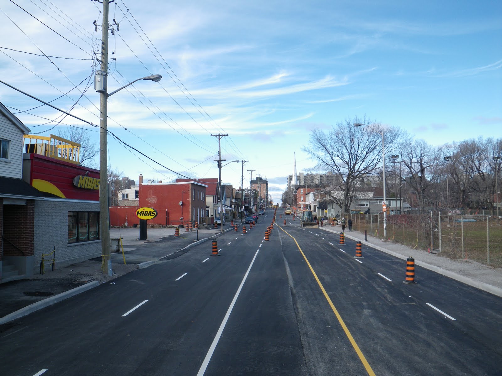
More often, however, they go in looking like Charlie Brown's Christmas tree, like these three installed on Metcalfe back in 2010:


When the Garden of the Provinces and Territories was built in the early '60s, it too had tiny trees, as seen in this photo via Urbsite


Half a century on, these trees have grown considerably, giving the park a much different (though not necessarily worse) feel. The canopy provides a low green ceiling to the park, making it a more private and reflective space to appreciate the grass and water features.


Street trees have a harder time than those in parks or front yards, due to the smaller area of land for rain to fall into and the increased exposure to salt, but they do sometimes make it. This row is on the north side of Place Bell, 160 Elgin at Gloucester. At the far left you can just make out Grant House (Friday's) and the construction site for the 150 Elgin office tower, mentioned above. The tree canopy has grown higher than the artificial canopy surrounding the building, but there is still much light coming through.


Closer to Elgin, the trees are noticeably shorter. There may be many reasons for this, but I suspect the tower of 160 Elgin blocks a lot of sunlight, stunting their growth. (Indeed, you can see in Google Street View that the one at the Elgin end, which would get more morning sun, is taller)


On the Nepean Street side of Place Bell looking west toward Metcalfe, the story is a bit different. The condo towers at 18 and 22 Nepean Street block out much of the light that would fall on the North sidewalk, the awning blocks out the sky immediately above, and the tree canopy blocks out the sliver of sky that remains. At eye level, there's little sunlight, and nothing but concrete, bare glass, and tree trunk to look at. The view on the North side will soon resemble this as 150 Elgin climbs toward the sky.


While we can't remove the buildings that are already there, we can make sure that as new towers are built there is sufficient space between them to let light through. The 27-storey tower approved for 91 Nepean and its identical siblings at 70 Gloucester and 96 Nepean, were approved by City Council on lots barely wider than the towers themselves. That sets a nasty trend: if the lots next door are allowed to be built the same way, we'll have a wall of building as dark as the one across from Place Bell, only twice as tall and closer to the street. There are trees shown on the drawings for 96 Nepean, but this is mostly eye candy on the drawings; we (and the future residents of the building) would be lucky if anything green grows at all.

It's actually fairly impressive how well these rows of trees surrounding Place Bell have survived in what looks like such small plots of ground*. And that's not a bad thing—removing these trees would certainly make this scene even worse—but the trees were originally added to soften the view at eye level, and now that they have grown beyond that height, something else is needed to fill this role so that this stretch of sidewalk can be more hospitable again. Maybe not a Zen pond, but something.

For now, the trees on the opposite side of the street at 150 Elgin will probably have to suffice.

(*See the street tree-related posts in my series on the reconstruction projects for Bank Street and Somerset Street)

[Tune in on Wednesdays at noon for a new pedestrian-themed blog post. View the Pedestrians label for previous Peds on Weds posts]

Thursday, November 22, 2012

3D Thursday: 201 Cooper Street

Older buildings, especially stone ones, tend to make good subjects for 3D photos because they tend to have more parts sticking out in front of others than more modern buildings. Being mostly grey, stone buildings are also more colour-balanced (important since red or blue objects tend to be bright in one eye and dark in the other due to the filters), though this applies to Brutalist concrete buildings too.

201 Cooper was one of the three stone buildings in this photo.

Source photos for the 3D image: Left, Right

Infamous local heritage expert David Jeanes provided some background on the building in a 2010 e-mail:
"There were many stone mansions built during the 19th century for wealthy Ottawa businessmen, but by the date 201 Cooper was built (1888-9), stone was becoming quite rare and most mansions were of brick. I noted that there are no heritage designated stone residences in Centretown, and I am not aware of any others that are as large or as close to original condition as 201 Cooper.

"The architect of 201 Cooper is not known, but it is similar in general plan, architectural style, and construction details to Italianate mansions designed by Henry Horsey, architect of the Nicholas Street Jail in 1860. He was 57 when 201 Cooper was built."

In 2010, the CCCA's Heritage Committee (which is now dormant) expressed concern about the level of heritage protection afforded to this building. As this Centretown News article documents, City heritage staff are adamant that the Heritage Conservation District is sufficient protection. Luckily, it doesn't look like the new Centretown Community Design Plan touches the District, though it does little to reinforce it, either.

Given that there are plenty of eligible buildings—with no heritage protection at all—vying for scant City funds for the research necessary for heritage designation, the District will probably suffice for now.

So let's just sit back and enjoy this nice stone building—in 3D!

[Tune in on Thursdays at noon for a new 3D image. View the 3D label for other posts with 3D images]
[Look for more one-photo posts under the label Singles]

Monday, November 19, 2012

Annual Centretown meeting on Wednesday

This Wednesday, November 21, 2012, the Centretown Citizens Community Association is holding its Annual General Meeting at McNabb Community Centre. In addition to the regular business of the association's members, such as electing directors to the Board, there will be presentations about issues affecting Centretown.

Back in May, the CCCA held a meeting, also at McNabb, to bring attention to the Centretown Community Design Plan. The meeting was very well attended by Centretown residents, many of whom hadn't heard of the CDP before the meeting.


The plan was already a year overdue in May and is still. After the City recently released a "final draft" of the plan a few years into the process, the development industry produced a lenghty document with line-by-line edits they want made to the plan. An update will be provided at the AGM on this recent development (pardon the pun) which will yet again postpone the plan going to Planning Committee for approval by City Council.

There will also be two presentations at Wednesday's meeting: "Achieving Results for Communities at City Hall," by Christopher Collmorgan, President of our neighbour association, Action Sandy Hill; and "Development — Yes! Lifeless Streetscapes — No!" by Paul Kariouk, Centretown resident and Associate Professor of Architecture at Carleton University.

The agenda and reports are available on the CCCA website (permalink), and the flyer contains bios of the two keynote presenters.


You can become a CCCA member (so long as you're from the area bounded by Bronson, the 417, the Ottawa River and the 417) at the meeting for only $5 per year, or if you can't make it you can also join and/or donate online. Your participation of time or money is what keeps the CCCA going as a voice for residents at City Hall on decisions affecting Centretown, and will also help us finance what promises to be an expensive OMB appeal of City Council's decision to rezone 96 Nepean Street for a 27 storey tower (I discussed that project and its context in this lengthy post.

At the meeting on Wednesday, you can also put your name forward for one of the eight positions (6 for two years, 2 for one year) on the Board of Directors for the election. As it happens, I am chairing the Nominations Committee, whose report is at the end of the longform agenda (a briefer one will be in hard copy at the meeting), so you can contact me (centretown dot ottawa at gmail dot com) if you would like to put your name forward or if you want more information. As you can read in the report, there is a shortage of candidates in the area west of Elgin and north of Somerset, and there are so far only 7 candidates. The Board members elected at the AGM will join those of us in the second year of our terms and from this group will be selected the Executive members: Vice-President, Corporate Secretary, Membership Secretary and Treasurer.

See you on Wednesday!

PS: Bronson Avenue should partially re-open to traffic tonight or tomorrow, one lane in each direction from Gladstone south. Ongoing work in the intersection at Somerset means a the section from Gladstone to Somerset won't reopen to through traffic for some months yet. Somerset to Laurier will fully close for construction some time next year.

Wednesday, November 14, 2012

Peds on Weds: Bench with a view?

The next Walk Ottawa meeting is this coming Monday, November 19, 2012 at 7pm at City Hall in the Honeywell Room. There is much to discuss since a Steering Committee was appointed at the September meeting. If you missed the group's October tour of the City's Traffic Operations Division building, you can relive the experience from a three part blog tour posted after a similar tour of the building in 2009.

Today's pedestrian content involves a curious discovery I made while having lunch this past summer at Burgers on Main. When Somerset Street was rebuilt between Elgin and Kent around 2006, the streetscaping in Somerset Village (the block of old houses-turned-restaurants on Somerset between O'Connor and Bank) included this bench:


The bench seems rather deliberately placed in front of that grey box, which doesn't make for very good viewing (nor does the partially-demolished Somerset House). However there is a lock on the box and it looks like there are doors that open. Maybe there is some sort of video screen inside intended as a forgotten piece of public art?

[Tune in on Wednesdays at noon for a new pedestrian-themed blog post. View the Pedestrians label for previous Peds on Weds posts]
[Look for more one-photo posts under the label Singles]

Thursday, November 8, 2012

3D Thursdays: Autumn in Minto Park

It's the time of year when the weather gets colder and the leaves change colours. It's also Thursday, which means today's post is in 3D. Get your red-blue glasses out for this great shot of Elgin Street's Minto Park:

Source photos for the 3D image:Left, Right

The focal point of the image is the statue of Argentinian General José de San Martin.

[Tune in on Thursdays at noon for a new 3D image. View the 3D label for other posts with 3D images]

[Look for more one-photo posts under the label Singles]

Monday, November 5, 2012

Mags & Fags switches up some more

In April, I posted that Mags & Fags cleared a newspaper rack out of their entranceway.

Even earlier in the year—in January—there was a water main break on Elgin Street right outside the store, closing it and Vanilla until water could be restored. There's a guy with a shop vac emptying out water that presumably got into his store's basement.


By the evening, crews (I presume from the City) had excavated a hole to expose the break in the water main. The vacuum truck on the far side of the backhoe is used to remove soil near gas lines, since a shovel can do lots of damage if it gets too close. You can also see the pipe leading up to the fire hydrant underneath the sidewalk, which, while unrelated, is still something neat you don't see every day.


Once the water main had been repaired, the hole was filled up and a cold patch was applied to cover it with rough asphalt. In the spring (June, actually), the road was resurfaced with good smooth asphalt, and the sidewalk was also replaced. An intricate ramp and plank system was used to retain access to the stores while the concrete sidewalk was curing. Some sections of sidewalk along Elgin Street were replaced when the street was resurfaced in 2011, and even more when Bell ran new cables under Elgin in 2010. Actually, Elgin Street's sidewalks have had over a century of turnover.


The minimalist magazine racks have been in the window for as long as I can remember. However, while I was walking past it last month, I noticed that they'd changed this up for a different style display.


The new shelves are busier than the old metal racks—two of which remain on either end of the display, but it works. It lets the store owners display other materials, to let potential customers walking by know that they don't just sell magazines.

Monday, October 29, 2012

Garbage in Centretown

If you're wondering why your garbage hasn't been picked up today, it's because the City has changed the garbage collection dates in coordination with the switch to collecting curbside garbage only every other week (green bin is still collected every week, and black and blue box pickups are still on alternating weeks). The best I can tell is Centretown east of Bank is on Wednesday and west of Bank (to Bronson) is on Thursday. Homeowners should have gotten letters by now, but if you're a renter like me, you can use the City's online tool to find out your new collection date.

On a less disruptive note, the CCCA recently heard back from Ontario Electronic Stewardship about the e-Waste dropoff site fundraiser we had earlier this month. As the CCCA tweeted this past weekend,


People came from across Centretown and beyond (one person said he was from Manotick!). The tracking form they give you only asks you to list the number of cars that pull up, but since only a quarter of Centretowners use a car as their primary mode of transportation, we had just as many walk-ups.

Friday, October 19, 2012

Five years since Somerset House collapse

While a petition and articles in both the Centretown News and Centretown Buzz have recently suggested that it happened in November 2007, the collapse of the wall at Somerset House in fact happened exactly five years ago, on Friday, October 19, 2007. In this post, which is the longest so far on this blog with 30 photos, I'll go over some of the highlights on and since that day that mark the ongoing saga of the historic building. Given the milestone, I'm publishing at 9am instead of noon.


As the Citizen reported the day after the collapse (I can't link directly to archived Citizen articles; you'll have to log in to the Proquest database with your Ottawa Public Library card and PIN and search for them), a 44-year old Bobcat operator was stuck under rubble for about two hours when the southeast part of the building collapsed on him just before 3pm.

When I got there around 7:30pm, the whole area was taped off by the fire department, and it was raining hard. The Fire Department had connected tethers from the north sidewalk across the street into the building.


An hour later, a large crane arrived on scene. I didn't stay around for much longer, since it looked like work would continue all night.

Wednesday, October 17, 2012

Peds on Weds: Juliana sidewalk replacement

This hill on Bronson Avenue is looking south from Queen Street to Albert (where the bus is going), across to Slater and up Nanny Goat Hill to Laurier. In the immediate foreground on the right is 100 Bronson, the Juilana Apartments, built on the site of Henry Bronson's mansion in the 1960s by Douglass and Ross, as described in the latter part of this URBSite post.

I'm more interested in the sidewalk in front of the luxury apartment building. The little white arrows are telltale signs that those broken concrete squares of sidewalk will soon be replaced.

Looking north from Albert Street, back in the other direction, we see the other end of the imminent repairs. The white arrows were added in early August.


In late September, the City replaced the concrete sidewalk. It wasn't done all in one pour, there was some left at the Albert Street end of the stretch when I stopped by:

The stretch of sidewalk that was replaced only extended as far as the stairs to the apartment building.

That black patch of asphalt was actually put there not by the City but by Enbridge, which also put down that square of asphalt across the street after some work they did in the roadway. Since Enbridge dug it up, it's up to Enbridge—not the City—to replace it.


On the one hand, it's unfortunate that the sidewalk couldn't have all been replaced in one go by whomever got there first, but all told this is probably the simplest way. An alternative would have the City paying to reinstall the sidewalk that Enbridge dug up, and either footing the bill (at the expense of other needed sidewalk projects) or administering the paperwork to pass the bill along to Enbridge.

In the end, the broken section of sidewalk will have been replaced and that's what really matters.

[Tune in on Wednesdays at noon for a new pedestrian-themed blog post. View the Pedestrians label for previous Peds on Weds posts]

Monday, October 15, 2012

Prince of Wales rail bridge

I've been out of town working at a conference, and am even further behind in my blogging and photo-sorting than when I left. So here's a quick blog post to get me started again:

Here is the Prince of Wales railway bridge, silhouetted by a recent sunset with the Ottawa River rippling in the foreground. It connects Ottawa and Gatineau, Ontario and Québec, with Lemieux Island partway along.


As you probably know, this is at the north end of the O-Train line. There is a pathway currently under construction that will run along the O-Train line to connect the Ottawa River Parkway to Dow's Lake, effectively closing the pathway loop for pedestrians and cyclists. When complete, the pathway will have the Prince of Wales bridge on the north end, and Prince of Wales drive at the other end.

[Look for more one-photo posts under the label Singles]

Friday, October 5, 2012

Crescent Moonset

As I was heading to meet friends for dinner in Somerset Village, a giant red crescent moon made itself apparent right in my path. I diligently got my tripod out and took photos from the middle of the street.


As I was fiddling with the camera settings, a party of twelve came out of Mama Theresa's and watched me while they tried to figure out what I was doing. When I returned to the sidewalk and saw they were still watching me as I put away my tripod, I pointed to the end of the street and said "look, the moon!"

One ventured hesitantly into the street, saw it, and was soon followed by the rest of the group to admire the spectacle. After a minute or two, they figured it was time they got out of the road. There's a certain bemusing thrill to stand in the middle of the street to admire a sight, especially when traffic is so sparse.


Generally the moon illusion is associated with a full moon, but clarly it works just as well with a crescent moon.

Back in May, I tweeted a similar photo of the moon over the Plaza Bridge by the NAC, Parliament Hill, Rideau Canal, and former Union Station. That was a cropped version of this one, which is a stunning and classic Ottawa nighttime shot even without the moon:

Wednesday, October 3, 2012

Peds on Weds: Why don't you have a seat?

This is under the entrance canopy of the Canadian Real Estate Association's national headquarters at 200 Catherine (to help locate it, you can see the nearby intersection of Bank and Catherine reflected in the building's mirror finish). The lot has plenty of landscaping at the fringes (like at Bank Street between Catherine and the 417), but the building itself is surrounded by parking and hard surfaces. This concrete planter box was installed at the entrance, perhaps to break up all the concrete, brick and glass.


But the flower planter seems to provide too much excitement, necessitating this hand-made sign shooing away people who might sit on it. The people who want to sit on the flower box are likely not doing so to spite the flowers, but because they want a place to sit. As the population ages, it's important to provide frequent seating opportunities around town to allow seniors to remain active but give them a place to rest (I know of many older adults who will walk to Hartman's and rest on the bench before going in to shop).

Considering that this is the only building on the block bounded by O'Connor, Catherine, Bank and the 417, my suspicion is that anybody who might want to sit there either works in the building or is visiting it (perhaps on a smoke break or waiting for a ride).

So why don't they just add a bench?

[Tune in on Wednesdays at noon for a new pedestrian-themed blog post. View the Pedestrians label for previous Peds on Weds posts]

[Look for more one-photo posts under the label Singles]

Monday, October 1, 2012

Winter & Summer across from Snider

Entirely by accident, I managed to take the exact same photo twice, six months apart. Just the tiniest amount of cropping and rotating was needed on these two photos of 353-355-357 Bank Street, on the east side between Laurier and Slater, across from Snider Plaza. Having done that, making an animated GIF of the two images was just irresistible:


From left to right, the stores are BabyFace, Bowitch, Jade Spa, and Kiddytown. It's interesting to see what changes and what doesn't. For example, unchanging are the "Summer Discount" signs in Kiddytown's windows, even in February. Under the 'change' heading, it is possible to see how the weight of the leaves weighs down the branches of the smaller tree.

Since the GIF reduces the image quality, here are the two source photos as JPGs (after rotation and cropping) in case you wanted to play with them. (Picasa 3.8 lets you view two photos side-by-side and zoom in, which is perfect for this). Click them to view/download larger. If you're sufficiently nerdy to want them, you'd probably also like to know that the summer photo was taken in August around 6:30pm, and the winter one in February around 3:30pm.


[Look for more one-photo posts under the label Singles]